Waitpinga to Tugwell Rd
 Complacency. Or apathy. How very Australian of us. Rain. I hadn't even checked the weather forecast. Someone, who I shouldn't name, hadn't even brought wet weather gear. At least I had brought it, but only because I just always did. I never expected to use it. Even when it started to rain, it was just a light drizzle. Oh, it will just cool me down a bit. If I stop to put on my rain jacket it will mean I'm accepting that it's raining. I would rather continue to deny that it was raining. But I finally succumbed, everyone else was wearing theirs, and I was getting rather wet.
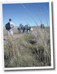
The day started off sunny enough. Rudy warned me of rain in the car. Ah whatever. It never rains for us. From about 11am onwards it rained on and off, just a drizzle, sometimes more. We ate lunch in the rain. It wasn't cold, just a little wet. And it wasn't wet, well, not really, just it was wet compared to all our other walks!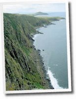 Walking along the clifftops, yep, the clifftops I never even knew existed, was spectacular. They just seemed endless, and around every bend they just seemed to get more spectacular. I took few photos at the start, indulging in some conversation with Sue and Michele and Rudy. I hadn't walked with any of them since the first End to End walk. There was much catching up to do! Later, I got distracted, fell behind and walked by myself for a while. There was no one in front of me, and no one behind. I took many photos, but I had missed taking any good photos of the fauna - I hate that word - and the flora. Today was a day filled with strange smells and wild flowers. I took the odd photo of them. I saw others taking better photos. Well, perhaps.
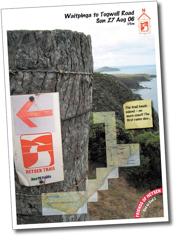
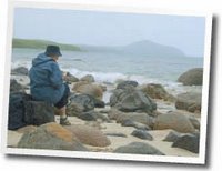 At the point at which the trail departed from the coast and headed inland, I took a few photos, of which one I used for my featured photo below. We spent much of the day walking towards The Bluff and West Island. Anyway, just past this crucial point of no return for the trail, I realised I had probably misread the map. The trail returned to the coast. Oh well, my photo was symbolic, not factual. We ate lunch on the beach. I didn't even know there was a beach there. With some sharper observation skills I could have established that though. It was called King Beach. It was a beautiful beach though, lots of rocks. And rain. Lunch was a much needed break for my very sore left knee, yep, the left one. Not the right one that I had been concerned about all week. That was fine. But my left one was bad. So a little rest, whilst gulping down my lunch in the rain, was very welcome.
Our group was quite well spread out. I hurriedly finished my lunch as the group prepared to walk on. Then the end of our group, those people so far behind me it felt like there was no-one behind me at all, caught up with us. Oops. So the group split, perhaps a little unwisely. The group leaders, and indeed the group, was in a bit of disarray. It was the rain. Blame the rain. As we turned that crucial corner that led the trail at right angles from the coast inland, for the second time, an ambulance waited by the side of the road. "For you?", enquired Sue. Mmm. Should have taken a photo. That was funny. My knee certainly wasn't. Stupid scooter accident has set my progress back more than six weeks.
We wondered why so many people had been standing in the rain in a paddock by a house. Was anyone as stupid as us? Horse riders and the people that follow that... horsies? Yep, they were as keen as us not to let the rain deter them! Later, we saw them jump a hurdle. Well, we could have, if we'd bothered to wait another ten minutes. They took forever to get themselves organised. So we gave up and walked on, they passed us some time later, and we got to see them jump another hurdle instead.
Michele, let it be known, distracted me on our walk along Jagger Road. We passed the trail turn-off, by about 300m. Oops. We backtracked. They all seemed to blame me. What, was I meant to be leading them? Just cos I had a map? That's why I blame Michele. Well, that's not really fair, but I did get some good advice about flying with cheap airlines: turn up on time, or better still, early. Cos they are cheap, they prob overbook. And yes, they really do. The drive home, and indeed going down there too, was good. Enjoyed the company of Rudy, Margaret, who I met last time on the beach and featured in my beach photo of us wearing no shoes, and her friend Sunny. Sunny, from Taiwan originally, had walked with another bushwalking club, that one I have heard a few negative things about, but found them quick paced, competitive perhaps. I think she really enjoyed walking with us today, at our relaxed walk-at-your-own-pace.