Sunday, May 27, 2007

The Rhinestone Cowboy that went too far

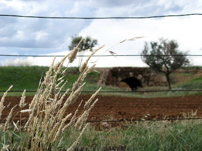
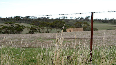
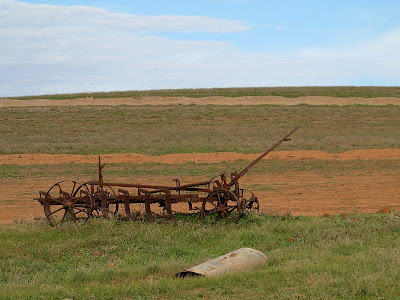
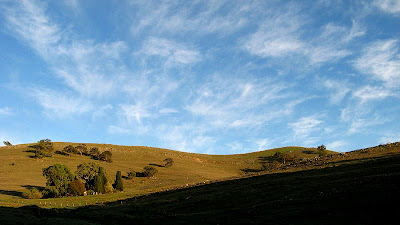
Mt Compass to Kyeema Conservation Park
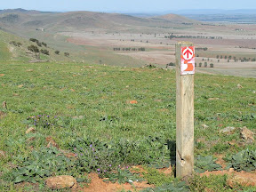
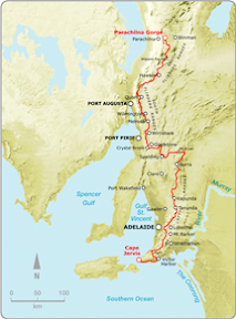
Southern Guidebook, Maps 2.6-2.8

Simon has a habit of singing as he walks. I guess you can't deny him that right. Doesn't mean you should either enjoy it or endure it - especially when his chosen theme for the day is country songs. American, but still, country and western... urgh. Thankfully he didn't seem to know many, and those he did he knew very little of, and he didn't seem to be getting much encouragement.

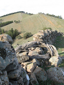
Well worth walking up along the short - but steep - spur trail to the peak of Mt Magnificent. Simon played his bagpipes at the peak, roll your eyes, actually, no, unroll your eyes, I don't mind his bagpipes. An adrenalin rush coming back down, I ran, yes, you read correct, I ran down, proving how much better my knees are this hiking season.

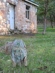
After discussions with another (who will not be incriminated here) about the activities that took place at the dubious looking Kuitpo Community - it had all the appearance of a cult hide-out. Think guns and terrorists, or at least churches and silly games. It was none of the above, I googled it, it's a drug and alcohol rehab facility with a fairly long history. Now that's cool. Glad I waved at that guy and he was too far away to see my questionably expression.

We escaped the bulls atop the hill near Blackfellows Road and walked onto the end of the walk. Here, just before the end, we set ourselves up in two lines, and led by Simon's bagpipe efforts we marched in to the other waiting hikers. Simon really got a showing this walk, heh? Finished off with some birthday cake for Jerry's 50th. Nice one.


Sunday, May 13, 2007

Fast Tracking

Locks Ruin to Bowman Park
Northern Guidebook, Maps 1.8-2.1

Today was a day with fast results. Finally, after many kilometres travelling from east to west, the trail again returned northwards, heading into the South Flinders Ranges. And much of the day was following parallel to two railways, an old, dismantled railway, curving sharply around the landscape in cuttings, and a second, straighter and flatter railway - the newer of the two - with frequent trains passing destined for Sydney or Perth. There was some discussion, perhaps the Heysen Trail should have followed this old railway - in the cuttings, rather than the adjacent roads. That would be more better, a bit of history as one imagined what once was.


Again, we passed down a mainstreet. This really has been unheard of before this weekend. Today, the main street of Crystal Brook. A few curious, but cool, iron sculptures with a little bit of history. The odd monument to join them.


Passing by the dry, so-called 'crystal brook', we left the town via the golf course, heading for Bowman Park. On a quiet dirt road we found a little oasis, an old, albeit rather dilapitated house, set carefully next to the 'crystal brook', a dam creating a wonderully reeded wet land.

After passing another hut, this time Bowman Hut, a rather modern well-facilitated hut, we reached Bowman Park. After a nice chat with some locals, Bill brought out his journal, a compilation of photos and text - magnificent photos showing landscapes and incredible detailed wildlife close-ups, all well lit and composed - how I love a good photographers work!


Saturday, May 12, 2007

Map Reading

Raeville to Locks Ruin
Northern Guidebook, Maps 1.5-1.7


"That's the ruin on the left over there, see, just under that tree. Marker 'F', that's just coming up in the valley ahead," instructed Raelene. "Ah yes, indeed, I see, so we are here," I replied, also carefully comparing the map to the landmarks around us. "Yup, and 'Dunleath', that's over there on the left." Um, no. That would be it on the right. "Oh, just when you and the other person think you have got it under control, I then go and prove I don't," she stated. We laughed. We climbed down the shallow valley, through the creek, and back up the other side, past the ruin. A different ruin. Oops. Karma. I was wrong too. Quite obvious really, it was about 2mm off the trail on the map, making it about 200 metres in reality - not about 1 km away as the ruins we saw on the hill. Raelene had undertaken a bushwalking leadership course recently. "Maps aren't my strength, but now, I have such a better understanding of map reading. I'm practicing," Raelene earlier stated. Lyn was practicing too, a particularly difficult aspect - intepreting the contours. Perhaps I should have done the course too, but generally, apart from moments of stupidity, I'm not so bad with maps.

Today we walked from the 'Raeville' homestead, near Georgetown, to Locks Ruin, somewhat near Crystal Brook. Some 20km, a good start to the walking season for the End-to-End 2 group. Of course I have done a few indy walks recently, so certainly appreciated walking with others, not having to navigate and having a bus to drop us off at the start of the walk, so we could walk back to our cars.

Lots of farmland today, a bit of road walking at the start, and, unusually, a walk straight down the main street, such as it is, of Georgetown. And you know why that is so unusual? It means a shop! So icecreams it was for morning tea, sitting in the local park - a playground, green lawns, benches and toilets - this was unusual!


Stayed at Gladstone Gaol on Saturday night. Most people had come up Friday afternoon or evening, but I had come up first thing Saturday morning. Don't think I will do that again, leaving at 6.30am for the two and a bit hour drive. The gaol was positively eerie. The guys enjoyed a beer together as the girls showered in the only working bathroom, before we had our go. It was nice, all (almost) staying together in one place. By the time I went to bed, in my cell, I wasn't so spooked by the claustro space, all our night's activities had personafied the space. Earlier, a guide took us on a tour of the 1880's gaol - used right up to the 1970's. So very rundown in places, and somewhat yucky, although not quite as bad as Melbourne Gaol - but perhaps this was because the guide knew so little personal stories of inmates. I never did take any photos of the gaol, I had thought I could take some nice sunrise photos, but the angles weren't right, and I didn't feel adventurous enough. Thankfully though, the place was already booked for the June long weekend. Phew. I might go camp in the Wirabarra Forest for the next hiking weekend.


Sunday, May 06, 2007

Riding Rough

Curnows Hut to Raeville
Northern Guidebook Maps 1.4-1.5


Today featured some rough riding. Well, truthfully, not. Perhaps better stated, "rough pushing a bike up a hill". Today I need to hike some 18km, and return, meaning I had 36km to hike. Too far for me to hike, especially when it is return (return seems so much harder than hiking one way). So I plotted to ride half the distance, and hike the second half, bringing the total riding distance to 18km, and the total hiking distance to 18km. Very achievable. The first 6km or so was on forest tracks, climbing up to the peak of New Campbell Hill - just 6 metres shy of the height of Mt Lofty. It was tough, pushing my bike up those hills. But it would be worth it, I knew riding home would be all down hill, even if because of the rough tracks it would be heavy on the brakes.

Near New Campbell Hill the Heysen Trail follows the ridge, as does a dry stone wall, similar to the High River wall that featured on the Dead Cow Quarry to Marble Hill Road walk. At the peak I was rewarded with magnificent views, with Bundaleer Forest on one side, the North Mount Lofty Ranges petering out, and the start of the South Flinders Ranges in the distant west. A transition point between the two major ranges.

I then rode predominately downhill, undulating, through some farmland, along a track. A little lamb followed me, which was a little unsettling because it was following after me and not the rest of the sheep. Alas, it grew tired, and somehow managed to rejoin the other sheep. It was cute. At the end of the track, I parked my bike on a farm fence next to a Heysen Trail stile, leaving an accompanying note to explain the oddity of a bike in the middle of no-where. I had ridden 8.4km, which took just over an hour.


I then hiked through open farmland, following a creekbed through a shallow valley. Pretty uninteresting. Leaving the farmland, I climbed to follow a ridge of a range, still part of the North Mt Lofty Ranges. Here I was rewarded with impressive views of the distant Bundaleer Forest, New Campbell Hill, the shallow farming valley, and a wide valley with farming, roads, the towns of Georgetown and Gladstone, and in the distance the start of the South Flinders Ranges and Mt Remarkable. Within a few kilometres of following this open ridge, I could see the Raeville homestead - the end of today's hike. I struggled on, determined to get close before turning around. A couple of kilometres later though, I gave up, I couldn't handle hiking to somewhere I could see, only to turn around and return. I had hiked about 1.5 hours, and was probably about 4-5km from Raeville.

I took numerous shortcuts on the way back, across the shallow farmland - rather than following the meandering creekbed, I headed straight for the distinctive windmill near my bike, saving an extra 30 mins from when I passed the first time. Back at my bike, I pushed my bike up a hill, following a fence line, saving almost 3km of riding. It was hard work, some of it I had to resort to carrying my bike (rather than pushing it). It then took just an hour to ride back to Curnows Hut, very heavy on the brakes.


Saturday, May 05, 2007

Following Never Never Creek

Bundaleer Reservoir to Curnows Hut
Northern Guidebook Maps 1.2-1.4

The map doesn't make it look that exciting, frankly. The Heysen Trail just follows the creek, forming a straightish overall line on the map. I was surprised though, there were a four distinct sections - each quite interesting. Firstly following one of the Bundaleer channels away from Bundaleer Reservoir, to a weir - with flowing water.


Secondly, there was the creek section, following a valley and fairly dry, the first half containing lots of thriving yacca plants, the second half was distinctly drier, and the hillsides full of dead yacca plants, a bit eerie.

Thirdly, this dry valley turned into an oasis with introduced trees and farms. It was quite a contrast, quite a sudden change too.


Fourthly the trail passed down an old road past some extensive and remarkably well surviving ruins of a farm. There was a cottage, and numerous sheds. They appeared to have been abandoned only within the last 30-40 years, perhaps sooner. There was no electricity connected, but plenty of old furniture and old rubbish around, not to mention the thatched roofs. Later in the day I noticed there were many old homes around Bundaleer, and some new homes - but nothing in between, which kinda indicated in the early years it was a thriving place, but almost everything was abandoned 30-40 years ago, with people only returning in the last 10-20 years, building new homes.

This was a catch-up walk, an End-to-End 2 walk I missed while in Thailand. I camped at Curnows Hut, a beautiful spot in amongst a pine forest. The hut dates from the 1870's and was the home of the first nurseryman at the historic Bundaleer Forest.

Bundaleer Forest was the first plantation forest in South Australia, and also the "birthplace of forestry in Australia". There was early concern that the State's precious native forest cover, never abundant, would be lost forever in the rush to find building materials. From 1873 the South Australian Parliament passed various acts to encourage the planting of forest trees, and in 1876 'Plantation A' - the first forest - was planted at Bundaleer. Many tree species - natives and exotics - were planted to see which would thrive in local conditions, and be commercially useful. Many of these trees, now a century and a quarter old, can still be seen at Bundaleer. The most successful product was the Radiata pine, today widely used in construction. There are other plantations along the Heysen Trail, at Kuitpo Forest and Mt Crawford Forest, but the vast majority of plantations of Pinus Radiatus are in the State's South-East. The first nurseryman at Bundaleer was John Curnow, whose cottage, known as Curnows Hut, is located near the original nursery. The timber from this plantation was used to build Spencer Gulf jetties, railway sleepers and in Broken Hill’s mines.


I rode the Mawson Trail from the hut, south-eastwards to the main bitumen road, then following some dirt roads back down to Bundaleer Reservoir - the ending place of the last End-to-End walk of last year. Well, almost, I got within a kilometre. I couldn't be bothered riding down there to hike back. Rode a couple of kilometres along the Heysen Trail to an aquaduct - part of one of the Bundaleer channels (see the Marble Hill Road to Bundaleer Reservoir walk). The ride was 23km, and mostly good roads so achieved it in about 2 hours. Left my bike there at the aquaduct, hiking northwards back to Curnows Hut. The hike was approx 16.5km and took 4 hours. After a little sleep in my hammock - conveniently tied between two pine trees - I returned with my car to pick up the bike.