skip to main |
skip to sidebar
Menu
Trail Tally
| Trail completed to date:
Estimates of the length of the Heysen Trail vary, see the trail length discussion (verging on a tedious bore). |
About this Blog
|
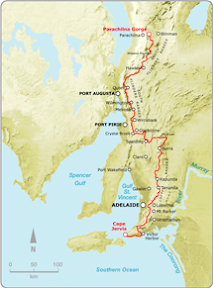
The Heysen Trail
Blog entry links listed below in geographical order, rather than chronological order (blog entries on this site in chronological order). However, I did start at the beginning of the trail at Cape Jervis, and finished the trail at the end of the trail, at Parachilna Gorge, in August 2008. The maps below refer to the official guidebooks, 'S' referring to the Southern Guidebook, and 'N' referring to the Northern Guidebook.
Cape Jervis to Cobbler Hill
Maps S1.1-S1.2
Cobbler Hill to Tapanappa
Maps S1.2-S1.3
(Walked again from Cobbler Hill to Waitpinga Beach
Maps S1.2-S1.5)
Tapanappa to Balquhidder
Maps S1.3-S1.4
Balquhidder to Waitpinga Beach
Maps S1.4-S1.5
Waitpinga Beach to Tugwell Rd
Maps S1.5-S2.1
Tugwell Rd to Inman Valley
Maps S2.1-S2.3
Inman Valley to Myponga
Maps S2.3-S2.4
Myponga to Mt Compass
Maps S2.4-S2.6
Mt Compass to Kyeema Conservation Park
Maps S2.6-S2.8
Kyeema Conservation Park to Dashwood Gully Road
Maps S2.8-S2.10
Dashwood Gully Road to Mylor
Maps S2.10-S3.2
Bridgewater to Hahndorf spur
Maps S3.3
Mylor to Cleland
Maps S3.2-S3.4
Cleland to Montacute Heights
Maps S3.4-S3.5
Montacute Heights to Cudlee Creek
Maps S3.5-S3.7
Cudlee Creek to Scotts Shelter
Maps S3.7-S3.8
Scotts Shelter to Mt Crawford
Maps S3.8-S3.9
Mt Crawford to Pewsey Vale
Maps S3.9-S4.2
Pewsey Vale to Greenock to Kapunda
Maps S4.2-S4.7
Kapunda to Peters Hill
Maps S4.7-S5.3
Peters Hill to Tothill Range to Webb Gap
Maps S5.3-S5.7
Webb Gap to Old Burra Rd
Maps S5.7-S5.9
Old Burra Rd to Worlds End
Maps S5.9-S5.11
Worlds End to Burra
Maps S5.11-S5.14
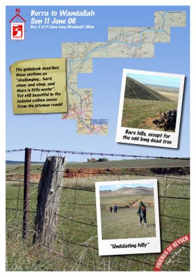
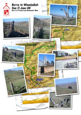
Burra to Wandallah
Maps S6.1-S6.2
Wandallah to Black Jack Shelter
Maps S6.2-S6.3
Black Jack Shelter to Caroona Creek
Maps S6.3-S6.5
Caroona Creek to Old Mt Bryan School House
Maps S6.5-S6.6
Old Mt Bryan East School to Hallett
Maps S6.6-S6.7
Hallett to Dead Cow Quarry
Maps S6.7-S6.9
Dead Cow Quarry to Marble Hill Road
Maps S6.9-S6.11
Marble Hill Road to Bundaleer Reservoir
Maps S6.11-N1.1
Bundaleer Reservoir to Curnows Hut
Maps N1.1-N1.4
Curnows Hut to Raeville
Maps N1.4-N1.5
Raeville to Locks Ruin
Maps N1.5-N1.7
Locks Ruin to Bowman Park
Maps N1.7-N2.1
Bowman Park to Beetaloo
Maps N2.1-N2.3
Beetaloo to Wirrabara Forest (old nursery)
Maps N2.3-N2.6
Wirrabara Forest (old nursery) to Block Nine Road
Maps N2.6-N2.7
Block Nine Road (Wirrabara Forest) to Murray Town
Maps N2.7-N2.9
Murray Town to Melrose
Maps N2.9-N2.11
Melrose to Alligator Gorge Road
Maps N3.1-N3.3
(walked again from
Melrose to Horrocks Pass
Maps N3.1-N3.5)
Alligator Gorge Road to Horrocks Pass
Maps N3.3-N3.5
Horrocks Pass to Mt Brown Creek
Maps N3.5-N3.7
Mt Brown Creek to Woolshed Flat
Maps N3.7-N3.8
Woolshed Flat to Quorn
to The Dutchmans Stern
Maps N3.8-N4.2
The Dutchmans Stern to Mt Arden South to Buckaringa Gorge
Maps N4.2-4.6
Buckaringa to Partacoona Road
Maps N4.6-N4.8
Partacoona Road to Jarvis Hill
Maps N4.8-N4.11
Jarvis Hill to Old Wonoka
Maps N4.11-N5.2
Old Wonoka to Mt Little station
Maps N5.2-N5.3
Mt Little station to Red Range Campsite
Maps N5.3-N5.5
Red Range Campsite to Bridle Gap
to Cooinda Camp to Wilpena to
Yanyanna Hut to Camp E to
Aroona Valley to Parachilna Gorge
Maps N5.5-N6.8
Maps S1.1-S1.2
Maps S1.2-S1.3
(Walked again from Cobbler Hill to Waitpinga Beach
Maps S1.2-S1.5)
Maps S1.3-S1.4
Maps S1.4-S1.5
Maps S1.5-S2.1
Maps S2.1-S2.3
Maps S2.3-S2.4
Maps S2.4-S2.6
Maps S2.6-S2.8
Maps S2.8-S2.10
Maps S2.10-S3.2
Maps S3.3
Maps S3.2-S3.4
Maps S3.4-S3.5
Maps S3.5-S3.7
Maps S3.7-S3.8
Maps S3.8-S3.9
Maps S3.9-S4.2
Maps S4.2-S4.7
Maps S4.7-S5.3
Maps S5.3-S5.7
Maps S5.7-S5.9
Maps S5.9-S5.11
Maps S5.11-S5.14
Maps S6.1-S6.2
Maps S6.2-S6.3
Maps S6.3-S6.5
Maps S6.5-S6.6
Maps S6.6-S6.7
Maps S6.7-S6.9
Maps S6.9-S6.11
Maps S6.11-N1.1
Maps N1.1-N1.4
Maps N1.4-N1.5
Maps N1.5-N1.7
Maps N1.7-N2.1
Maps N2.1-N2.3
Maps N2.3-N2.6
Maps N2.6-N2.7
Maps N2.7-N2.9
Maps N2.9-N2.11
Maps N3.1-N3.3
(walked again from
Melrose to Horrocks Pass
Maps N3.1-N3.5)
Maps N3.3-N3.5
Maps N3.5-N3.7
Maps N3.7-N3.8
to The Dutchmans Stern
Maps N3.8-N4.2
Maps N4.2-4.6
Maps N4.6-N4.8
Maps N4.8-N4.11
Maps N4.11-N5.2
Maps N5.2-N5.3
Maps N5.3-N5.5
to Cooinda Camp to Wilpena to
Yanyanna Hut to Camp E to
Aroona Valley to Parachilna Gorge
Maps N5.5-N6.8
Blog Entry Category Labels
- 2006 (24)
- 2007 (27)
- 2008 (21)
- 2009 (2)
- 2010 (1)
- 2011 (1)
- Catch-up walk (13)
- End-to-End 2 (33)
- End-to-End 3 (16)
- Missed walks (now done) (9)
- Off the Trail (5)
- Pack-carrying (5)
GPS Maps
A note about the GPS maps appearing on this blog. Prior to September, 2007, all Google Maps are mash-ups, drawn on-screen. Initially, I favoured the satellite image as the determining where to draw the trail, but later I started to rely on the map view to determine where to mark the track - this being more accurate when satellite images would later be updated (the map and satelite often don't closely match up). As of September, 2007, all maps are generated from a GPS unit, so can be considered accurate (particularly when looking at the map view). Of course that doesn't stop me from wandering off the trail... |
How I walked
Intro |
3 Year Walking Plan
- April 30 2006 - the Heysen Trail commenced at Cape Jervis
- Cape Jervis to Mt Compass
End to End 3 - 2006 - Mt Compass to the Cudlee Creek
End to End 3 - 2007 - Cudlee Creek to Webb Gap
End to End 3 - 2008 - Webb Gap to Georgetown
End to End 2 - 2006 - Georgetown to Quorn
End to End 2 - 2007 - Quorn to Parachilna Gorge
End to End 2 - 2008 - August 17 2008 - the Heysen Trail completed at Parachilna Gorge


No comments:
Post a Comment