Fast Tracking
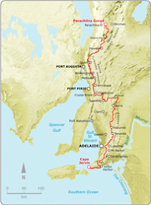
Locks Ruin to Bowman Park
Northern Guidebook, Maps 1.8-2.1
Today was a day with fast results. Finally, after many kilometres travelling from east to west, the trail again returned northwards, heading into the South Flinders Ranges. And much of the day was following parallel to two railways, an old, dismantled railway, curving sharply around the landscape in cuttings, and a second, straighter and flatter railway - the newer of the two - with frequent trains passing destined for Sydney or Perth. There was some discussion, perhaps the Heysen Trail should have followed this old railway - in the cuttings, rather than the adjacent roads. That would be more better, a bit of history as one imagined what once was.
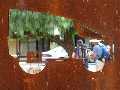
Again, we passed down a mainstreet. This really has been unheard of before this weekend. Today, the main street of Crystal Brook. A few curious, but cool, iron sculptures with a little bit of history. The odd monument to join them.
Passing by the dry, so-called 'crystal brook', we left the town via the golf course, heading for Bowman Park. On a quiet dirt road we found a little oasis, an old, albeit rather dilapitated house, set carefully next to the 'crystal brook', a dam creating a wonderully reeded wet land.
After passing another hut, this time Bowman Hut, a rather modern well-facilitated hut, we reached Bowman Park. After a nice chat with some locals, Bill brought out his journal, a compilation of photos and text - magnificent photos showing landscapes and incredible detailed wildlife close-ups, all well lit and composed - how I love a good photographers work!


No comments:
Post a Comment