Showing posts with label End-to-End 2. Show all posts

Saturday, August 16, 2008

A Final Week on the Trail

To see the fullness of the trail there's no better way to experience the trail but with a pack and tent.

8 days: Red Range to Parachilna Gorge
Northern Guidebook, Maps 5.5-6.8

Spent the week out on the Heysen Trail, camping and hiking with Graham. We thought we might get away from the big group of End-to-End 2, make our own path for the week. We joined them on the final day's hike into Parachilna Gorge.
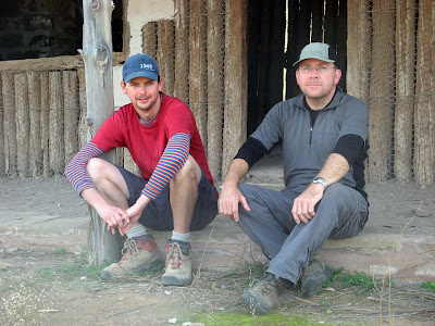

Me and Graham at Aroona Hut

On Saturday we drove up and did a scenic flight over the Flinders - taking in where we would be walking over the next 8 days. An amazing view, what a clear understanding we now had of the journey we were about to undertake! A few days later, hiking from Wilpena Pound, Graham waved at random planes who might have Bev on them (as it was their rest day). We thought it wise to stop that though, per chance a plane thought we needed assistance!
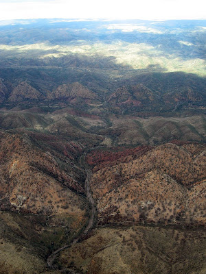

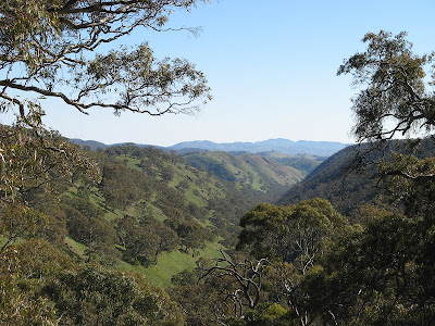
Bunyeroo Gorge

What I love about camping on the trail, is being able to witness what I consider some of the best times of day - sunrise and sunset. From Bridle Gap on Wilpena Pound's edge we were witness to not only a spectacular sunset but also the sunrise. However, it was quite cold, overnight temperatures ranged between -1.5C and 0C - but a fire each night kept us warm before bed.
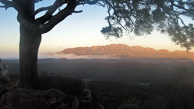

Sunrise from Bridle Gap with Elder Range in the background

Mid week we stayed in backpacker's accommodation at Wilpena, it was nice to have a shower, warm room and bed and a nice pub meal. The following day we detoured slightly to go past Old Wilpena Station, which used to be quite close to the trail, but now, I guess due to money making concerns, the trail gives it a wide berth.
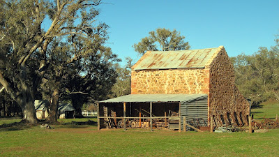

Old Wilpena Station

Of course, water is the biggest issue of this section of trail. When fully loaded so to speak, we were each carrying 4.5kg of water, which to say the least was quite heavy. We had to carry this much water to campsites with no water supply, or on the occasion we chose a random spot to camp. Camp E we called it, beside a creek, the name derived from the E symbol on the profile of that trail map.
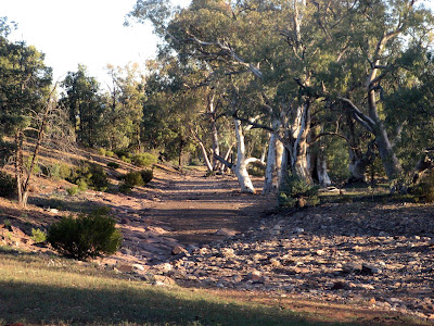

Camp E

It was a highlight to receive a gift of Ice Coffee and chips at Aroona Valley on the Friday near the end of the week. We met up with the main group for the first time, which was quite intense after a week on the trail largely by ourselves.
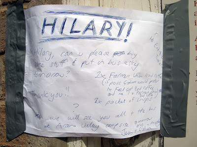
Hilary, bring us Ice Coffee!

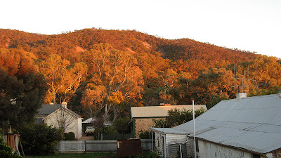
Aroona Valley was a special place to me - I had camped here for the first time back in 2007, indeed, only my second time to this area of the Flinders. It's an amazing place, so quiet at the start and end of the day. My hopes for a spectacular sunrise were thwarted by a cloudy sky and fog over the Heysen Range.
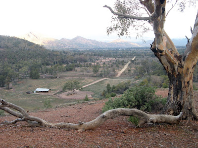

Aroona Valley

The first time I came to this part of the Flinders, back in June of 2005, I fell in love with hiking after doing the St Mary Peak loop. Despite a knee injury - a sign of things to come hiking - I was inspired to join a hiking group, which is how I came across the Friends of the Heysen Trail.
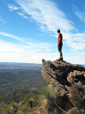

The climb up to St Mary peak

The final day we hiked an hour from Aroona Valley and waited at Pigeon Bore for 2 hours for the group. Here we walked the final 13km to the end of the Heysen Trail at Parachilna Gorge. It was quite surreal to watch the distance to the end of the trail decrease on my GPS unit. Walking this day was through quite an unknown area to me, and truly a stunning and fitting end to the trail.
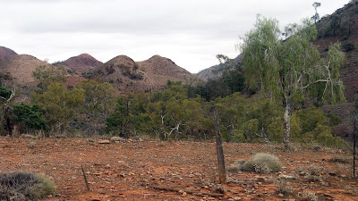

The final few kilometres

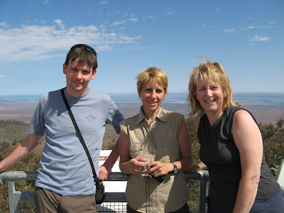
Well, some 580 photos later, the week was done as we climbed over the stile marking the end of the Heysen Trail. Nine of us were finishing today - Me, Ralene, Elizabeth, Hilary, Jim, Nikki, Bev, Rhonda & Gavin.
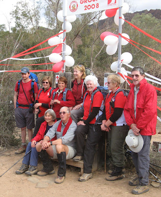


After a ride home from Richard and Nikki via the Parachilna Road, that night we celebrated at The Woolshed restaurant at Rawnsley Park. Various awards were handed out:

  • Me - the Nelson Mandela Award for dealing with the South African problem
  • Hilary - the Garmin GPS Award for walking the whole trail without having any idea where she was
  • Ralene - the Shrinking Violet Award
  • Bev - the Attracting the Waitress Award for her unique style at Laura
  • Nikki - Award was for Determination
  • Rhonda - the Ants in Her Pants Award for her two encounters
  • Elizabeth - (I can't quite remember)
  • Jim - (I can't quite remember)
  • Gavin - the Mathematics Award for genius maths or for producing plausible & convincing answers


And Nikki sang us a special song - Climb ev’ry Mountain (words and music by Rogers and Hammerstein, adapted by Nikki Birrell. With apologies to the Reverend Mother!)

Climb ev’ry mountain,
Hike high and low.
Follow ev’ry trail sign,
Ev’ry path you know.

Climb ev’ry mountain,
Ford ev’ry creek.
Follow all the leaders,
‘Til your legs grow weak.

Climb ev’ry mountain,
You’ll start at the KI ferry.
Somewhere, someday along the way
You’ll be led by a guy named Jerry.

Climb ev’ry mountain,
Descend into Deep Creek.
You’ll think you’ve reached the depths of Hell.
Of this I’ll no more speak.

Climb ev’ry mountain
From Bryan to Mount Brown.
And when you’ve climbed the loftiest peak
You’ll lunch... and then climb down.

Climb ev’ry mountain
Until their names don’t matter.
You’ll meet a group so debonair
They dine off a silver platter.

Climb ev’ry mountain
Meet Jez whose walking pace is a jog.
Beware of what you say or do
Or you’ll end up on his Blog!

Climb ev’ry mountain
With a fifty year old guy called Trevor.
At morning tea, Tim Tams are free
But they stay on your hips forever!

Climb ev’ry mountain
The Gavins, they come in threes.
One has a coach, number two has Christine
And three hammers nails into trees!

Climb ev’ry mountain
With the nuts from the fruit cake committee.
They aim to replace all the fat from your waist –
That you lost on the way. What a pity!

Climb ev’ry mountain
It’ll rain along the way.
The roads are boggy, the kilt gets soggy
But Barry will save the day!

Climb ev’ry mountain
Until your muscles harden
And then you’ll try and try again
Until you’ve climbed MOUNT ARDEN!

Climb ev’ry mountain,
The going will be tough.
With blisters, bunions and broken bones
You’ll know when you’ve had enough.

Climb ev’ry mountain,
And when your legs, they fail
You’ll walk with Tail-end Charlie
Along the Heysen Trail.

A trail that will need
All the strength you can give.
Just one weekend a month
For as long as you live.

Climb ev’ry mountain,
Walk the Heysen Trail.
Sing-a-long with Simon,
Or you’ll end in Gladstone Gaol.

A trail that will need
You to walk with a ‘friend’.
Just one step at a time,
‘Til you reach Flinder’s end.

Climb ev’ry mountain,
Ford ev’ry stream.
Follow ev’ry rainbow
‘Til you find your dream.

I’ve climbed ev’ry mountain
From Cape Jervis by the sea.
I’m over the hill at Parachilna.
So what’s to become of me?


View photos as full screen slideshow


Stats:

Sunday, June 15, 2008

84% of Heysen Trail complete

Just completed 7 days hiking on The Heysen Trail, now just 172km remains before I finish the trail in August of this year.

Buckaringa Gorge to Red Range Campsite


Rain disrupted the first two days, however the next five days went without a hitch:

I now have the following sections to complete:
  • June 22: Scotts Shelter to Mt Crawford (End-to-End 3)
  • July 19-20: The Dutchmans Hut to Mt Arden South campsite to Buckaringa Gorge
  • July 27: Mt Crawford to Pewsey Vale (End-to-End 3)
  • August 9-17: Red Range Campsite to Parachilna Gorge


Saturday, June 14, 2008

The Pound is here

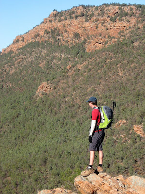
Reached within close sighting distance of Wilpena Pound today. It has been on the horizon for a few days, but now it's immensity is before us.

Mt Little station to Red Range Campsite
Northern Guidebook, Maps 5.3-5.5


Wilpena Pound is a huge landmark for me in completing the Heysen Trail. The Pound is now just one day's walk away, and only 6 days from the end of the trail.


View photos as full screen slideshow


Stats:
  • Distance: 17.6km + 3km
  • Odometer: 139km
  • Start time: 9.40am
  • End time: 3.53pm
  • Moving duration: 5h08m
  • Stationary duration: 2h03m
  • Moving average: 5.0km/h
  • Overall average: 3.4km/h
  • Max speed: 12.7km/h

Friday, June 13, 2008

Lucky Miles


The spot for today was the rock pools in Wonoka Creek in Mayo Gorge - the filming location for the WA rock pools scenes in the movie Lucky Miles

Old Wonoka to Mt Little station
Northern Guidebook, Maps 5.2-5.3


Mayo Gorge - the filming location of scenes from Lucky Miles

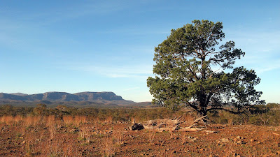
We followed a creek all day, Wonoka Creek. Just 15 months ago the floods near Hawker had seen this creek up to 10 metres deep with raging water - evidenced by the huge trees deposited high up against standing trees and up on the bank. Typical of the Flinders, the creek was wide and flat, but high on the banks you could see just how wide this huge creek would have spread.

We had lunch at Mayo Hut, a great spot to spend the night on a bend of Wonoka Creek. Jerry stretched the start of lunch out so we could reach the hut, however after lunch it was just 1 kilometre of the trail before we left the trail and walked another 1 kilometre out to Mt Little station. Here was another good camping spot, including toilets, showers and a great camp kitchen and shelter.


View photos as full screen slideshow


Stats:
  • Distance: 15km + 1.7km
  • Odometer: 118.3km
  • Start time: 9.16am
  • End time: 2.34pm
  • Moving duration: 3h40m
  • Stationary duration: 1h37m
  • Moving average: 4.5km/h
  • Overall average: 3.1km/h
  • Max speed: 14.8km/h (that was a run btw)

Thursday, June 12, 2008

Special places

There are a few spots along the Heysen Trail that are very special, and this walk is along one of them - Yourabulla Range.

Jarvis Hill to Old Wonoka
Northern Guidebook, Maps 5.1-5.2


View from Yourabilla Range

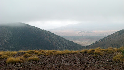
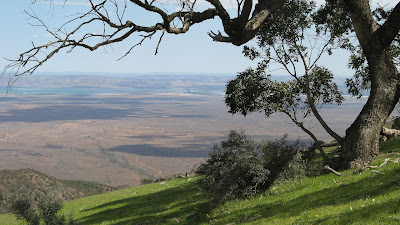
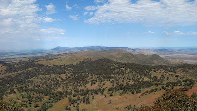
There are just breathtaking views from the ranges over the Yilson Valley towards the Yappala Range in the west and The Wide Range and Red Range in the east and Wilpena Pound in the north.

Only 9km today, half along the range, half along the plain.


View photos as full screen slideshow


Stats:
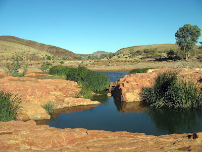
  • Distance: 9.81km
  • Odometer: 101.6km
  • Start time: 9.23am
  • End time: 1.49pm
  • Moving duration: 2h50m
  • Stationary duration: 1h34m
  • Moving average: 3.5km/h
  • Overall average: 2.2km/h
  • Max speed: 7.6km/h

Wednesday, June 11, 2008

The Paranormals

The Normals, the Abnormals and the Paranormals. Today we had a handicapped start, the Paranormals first, followed by the Normals - the deciders of these names - and finally by the fastest hikers, the so-called Abnormals.

Partacoona Road to Jarvis Hill
Northern Guidebook, Maps 4.8-4.11


Like yesterday, the bus couldn't cross Kanyaka Creek, so two 4WDs ferried us the 6km to the start of today's hike - the end of yesterday's hike. It would be a long day - 26km - so the slowest hikers were ferried first so they could start walking.

Suprisingly, us Paranormals didn't catch the first yet slow group until they stopped 6km down the trail, we never even caught sight of them.

Not a lot to see today, well, the same view all day basically. Lots of marginal grazing land, old and rundown fencing demonstrating just how marginal the land is. A climb at the end of the bus on Jarvis Hill.


View photos as full screen slideshow


Stats:

  • Distance: 26.8km
  • Odometer: 91.79km
  • Start time: 8.58am
  • End time: 4.10pm
  • Moving duration: 5h35m
  • Stationary duration: 1h35m
  • Moving average: 4.8km/h
  • Overall average: 3.7km/h
  • Max speed: 8.9km/h

Tuesday, June 10, 2008

We really are OCD

Due to heavy rains the bus could only make it so far to today's end point, so we had to walk 5km past the bus to ensure we walked that section of trail - then had to return that 5km back to the bus.

Buckaringa Gorge to Partacoona Road
Northern Guidebook, Maps 4.6-4.8


Willochra Creek

Buckaringa Gorge was spectacular - huge surreal rockfaces. Willochra Creek was also a treat, flowing of course, so a tricky crossing and a climb up a rickety ladder.

A few falls today, muddy bums and so forth. The bus ride home was also a bit tricky with muddy roads.


View photos as full screen slideshow


Stats:
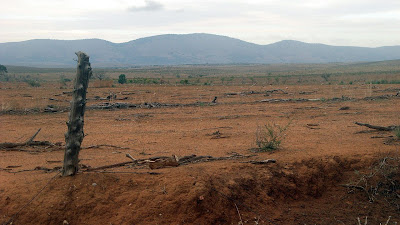
  • Distance: 21.5km + 2km
  • Odometer: 64.99km
  • Start time: 9.48am
  • End time: 4.17pm
  • Moving duration: 4h 33m
  • Stationary duration: 1h 55m
  • Moving average: 4.7km/h
  • Overall average: 3.3km/h
  • Max speed: 13.4km/h

Sunday, June 08, 2008

Most effort for least trail distance covered

Today the roads were wet. Our first attempt to reach the trail failed, so we made new plans. Having walked 9km to reach the trail, we made it just 450m along the trail before giving up and returning.

Mt Arden attempt
Northern Guidebook, Map 4.5


The climb towards Mt Arden

We had planned to walk from The Dutchmans Stern to Eyre Depot today, but yesterday due to recent heavy rains we changed it to the second planned day, from Eyre Depot to Buckaringa Gorge. This was so we could do the longest, hardest walk of the week before it got any wetter. Unfortunately it was just too wet for the bus on the muddy track, so after driving 17km from Port Augusta down a track towards Eyre Depot, we turned around. We formed a Plan B, go to the Arganells property - a 4WD, mountain biking and hiking property - to access the trail near Mt Arden, then walk to Buckaringa Gorge.

After three hours in the bus to reach that point, we hiked a short distance before having a morning break in the an old girl guides hall that had recently been moved on site.

We then set off through Hammersley Gorge - this area was just beautiful, stunning indeed. However by the time we had actually reached the Heysen Trail, some 9.5km later, we walked just 450m along the trail before giving up. The walk to the trail was ok, it was in sheltered valleys, but now we were to walk on an exposed ridge for the next 8km or so, it was just too windy and cold. We turned around and returned to the bus.

So we had spent 3 hours driving and 6 hours hiking to hike a mere 450m along the trail. Not much colouring in to be down in the trail guide this day.

The rain had got heavier, and the track wetter as we returned to the bus, so Monday's hike was canceled, pending better weather on Tuesday.


View photos as full screen slideshow


Stats:
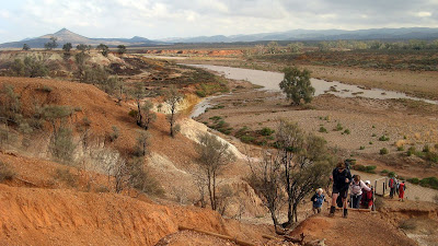
  • Distance: 19.3km
  • Odometer: 24.59km
  • Start time: 9.46am
  • End time: 3.41pm
  • Moving duration: 4h 22m
  • Stationary duration: 1h 32m
  • Moving average: 4.4km/h
  • Overall average: 3.3km/h
  • Max speed: 14.1km/h

Sunday, October 14, 2007

Quorn to Dutchman's Stern

Meh... I was pretty sore from training for the Trailblazer the previous day.

I'll catch up this weekend walk next year.

Saturday, October 13, 2007

Sunday, September 09, 2007

Robyn's Tail-End Charlie duty

Just a few hundred metres before the cars, we assigned Robyn the honourary position of Tail-End Charlie. It was tough, she had to deal with people threatening to jump off bridges and people tripping.


Mt Brown Creek to Woolshed Flat
Northern Guidebook, Maps 3.7-3.8

Robyn finished the Heysen Trail with this hike. She had joined the End-to-End 1 group in Quorn back in 2005, as they headed northwards to the end of the Heysen Trail. So as we neared the end of today's hike, we assigned her the position of Tail-End Charlie - the person who ensures no-on is left behind. As we walked under the road bridge near the cars, Tony and Dawn joined us to cheer Robyn on.


Thinking perhaps someone might challenge her achievement - you know who you are - in regards to an incident that took place beyond Burra, when after following a fence along treeless hills, up and down, we found ourselves in a valley where we had to hike up a hill, turn 90 degrees and return down the hill. A few of us, including myself, Robyn and George Adams, decided to shortcut along a creek, thereby avoiding this seemingly pointless hill. That night, George was given such a hard time about it, that in the following days he drove back out there, and climbed up this hill. So, back to today, Robyn was prepared for someone - we know who we are - to challenge her on this. So pulled out her scissors, and just nipped off one of the corners of her certificate.


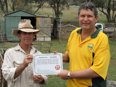
I really enjoyed today's hike, it was one of the best I've had this year. The day started with a 3km hike from the cars, parked near a homestead (by the gracious permission of the owner), to where we left the Heysen Trail the previous day. It was quite warm, but we had a quick shower of rain. Hiking towards the ominous Mt Brown, we came across a farmer and his family at a shed adjacent the trail. He'd been tipped off that we would be passing by, we had a plaque to erect adjacent a water tank that had been paid for by the End-to-End 1 group. Apparently, during that hike in May of 2005, David Beaton had come across this farmer working hard at erecting a shed. After some interrogation (as the farmer put it), it was agreed that when the shed was complete a tank could be installed that would serve the needs of the farmer, the CFS and hikers. So today we presented the plaque. To Bill's disappointment, it was not to be mounted today, that would wait until the farmer had erected a new fence. Bill didn't need to carry that cordless drill today after all...


Hiking up Mt Brown was a challenge, not the least because we wandered a little off the trail. It was steep, but the views though were the best I have ever seen on the Heysen Trail - stunning!


Lunch at the summit was well deserved. Bill and I set off with my new GPS unit to find a geocache, which we didn't find with the GPS at all, but with Bill's instinct (url cache details and comments).


Hiking back down from Mt Brown we followed in the dust trail Graham left, glimpsing his shadow in the far distance when we rounded corners. The hike down was easy, the gradient and track was very different to the hike up from the south side - it was gentle gradients, zig-zagging down (or up?), and the track was clearly marked with signs every 200 metres.

The last 6kms or so was following Waukarie Creek back to Woolshed Flat. Very pleasant.


I tried a new technique with my GPS unit, fixing it to the top of my pack, so it was lying flat. Apparently it has superior reception like this (the same way you would hold it to read it), and indeed the map tracking was flawless today.

And on a personal note, these blog enties will probably take a little longer to appear in future, I resigned from my job today, taking up a new job with the marketing company Adcorp - promising to be much busier!


View photos as full page slideshow


More detailed stats now with my GPS unit.

Stats:
  • Distance: 19.9km
  • Moving average: 4.4km/h
  • Moving duration: 4h 35m
  • Stationary duration: 2h 44m

Saturday, September 08, 2007

Bed at 5 minutes to 8

It must have been a tough day. Everyone had left the pub by 5 minutes to 8, most heading straight off to bed.


Horrocks Pass to Mt Brown Creek
Northern Guidebook, Maps 3.5-3.7

We had a couple of newbies, Hayden and Michelle from Roxby. I think they really enjoyed it, but it was a lot tougher than I think most of us thought it would be. Up and down hills, some really good views, mostly following a fire track and fence. Blisters and knee problems finished Hayden and Michelle off though, perhaps they'll come back for next month? It's relatively close to home (nothing much is close to Roxby Downs...).


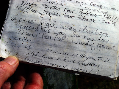
We came across a visitor's book near the top of Cudmore Hill, and found the entry that End-to-End 1 had left whilst passing by in 2005.


I tried out my new GPS unit today, but when I downloaded the maps later back at the Backpackers in Quorn, there were two significant areas of about 3km each where the GPS had difficulty tracking, resulting in a crazy almost random seeming map.

We finished back at the cars late in the day, so were treated to some very warm sunset lighting. The end of today's hike was inaccessible by car, but the owners of the Broadview property had graciously allowed us to park on their property, but we still had to hike 3km off of the trail to our cars.


We were based in Quorn this weekend, many of us electing to stay at Andu Backpacker's Lodge, an old converted hospital. About 60 beds, and 3 showers... mmm... Basic but comfortable. We were all awoken (as was the rest of the town) at 5.10am by a 5 minute blast of the fire siren - very loud - with the associated sound of people, trucks and water pumps.

Tea at the Austral pub (one of Quorn's 5 pubs?) was ok, meals were smallish, especially after our big hike. We had to preorder our meals in the morning, and obviously that extended to dessert too, because we didn't pre-order that and they ran out of ice cream. Ice cream is so hard to keep... we enjoyed some wine care of Tony and Robyn, celebrating Robyn's impending completion of the Heysen Trail tomorrow.


View photos in full screen slideshow


More detailed stats now with my GPS unit.

Stats:
  • Distance: 19.8km
  • Moving average: 4.4km/h
  • Moving duration: 4h 30m
  • Stationary duration: 2h 20m

Sunday, August 12, 2007

Spectacular Views

Alligator Gorge Road to Horrocks Pass
Northern Guidebook, Maps 3.3-3.5

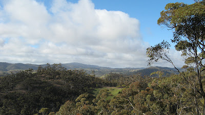
Spectacular views from the top of the unofficially named Lavender Peak. Named in honour of Terry Lavender, architect of the Heysen Trail. The Friends of the Heysen Trail applied to the Geographic Board to have it named so, but apparently current practice is not to name features after people. There was a cairn there, so people added some rocks.


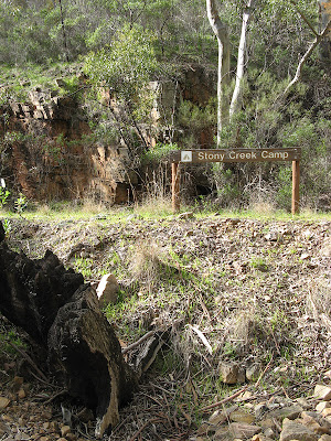
Some bush-bashing out, we headed down the steep hill to Stony Creek Camp. From here, the spectacular finished, we exited Mt Remarkable National Park. My knee was quite sore, so I was glad of the flat terrain.


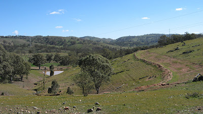
We hiked along a fire track beside a pleasant creek, then followed a bitumen road and some other road reserves. Near our lunch stop we could see Horrock's Pass in the distance.


The last 4km was following the bitumen road through Horrocks Pass. Not very interesting, walking on bitumen roads, but apparently the last bitumen road walking. Cant overstate how good that would be!

  • Distance: 14km
  • Hike time: 10am (??) to 2pm
  • Clear, but cool, 15 degrees maybe


View map in full screen mode

Saturday, August 11, 2007

The End

Melrose to Alligator Gorge Road
Northern Guidebook, Maps 3.1-3.3

No, not my end. Lyn and Helen finished the Heysen Trail today. Previously it has also been the end of people hiking the Heysen Trail - meaning it was so tough they gave up. Also, my end of the Heysen Trail is now in sight, with a detailed itinerary released today for next year's two weeks away, so I will finish the trail in August (2008).

It was a tough hike, harder than the Sea-to-Summit hike of a few weeks ago, climbing up to the summit of Mt Remarkable, then on to the road that leads into Alligator Gorge. The hike to the summit wasn't hard, 7km long but gently winding it's way up, but the 16km after that was tough!


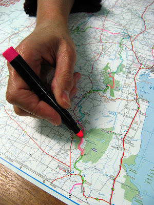
Lyn marks the final section off on her map

Also, the end of the trail is now in sight for me. I was to have completed 50.25% (let's call it 50%!) of the Heysen Trail after tomorrow's hike. But I was told the Heysen Trail was 1,197km long when last officially measured (re-routes would have varied that a little, give and take) around 2000 or so. I thought it was last officially measured at 1,144km... so this weekend I was to hike from 47% to 50% complete... but now with that new info, after Sunday's hike it would be just 48% complete. That may not sound too close to the end, but it is now just 1 year until I will complete the trail. Jerry handed around a detailed itinerary for our two weeks away next year (2008), one week's hiking in June, and another in August. So with the rest of the scheduled hikes for this year, a few extras, and the End-to-End 3 hikes between April and August, I will finish the Heysen Trail at Parachilna Gorge in August. Yay! That's not really so far away, heh?

As today was a long, tough hike, we started at 7am from Melrose, opting to get the bus to return us to Melrose at the end of the day. As it was, the 23km took us until 4.30pm to complete. I enjoyed starting early, we got to enjoy those few wonderful hours in the morning as the sun rose, with superb photos of Mt Remarkable and views over Melrose on the hike up to the summit. I needed to get a cover photo for the upcoming Trailwalker, so I took lots of portrait shaped photos on the hike up to the summit. Maybe I have something. I should really think more about these things in the three months leading up to each Trailwalker.


We walked across a few areas of screed, a nice word for rock fall really. Huge areas had succumbed to rock falls, but were relatively stable - if you can believe it - when a path had been flattened out across it. On one particularly large area, the sound underfoot was unsettlingly hollow. I stepped just off the edge of the flattened path to take a potential Trailwalker cover photo, and oh my goodness, it was very unstable just off the path. It's a wonder that the path is safe. It was in this section we also saw the remains of a light aircraft that had crashed on the mountain in heavy fog whilst descending to Port Pirie from Broken Hill. Everyone was so callous, they didn't even check the wreckage for survivors! What if this crash had happened just last night? Of course it hadn't, the wreckage has been there since the 1970's. I gather that the plane wreckage has been slowly moving it's way down this rock slide, breaking up more and more over time.


There were some very steep sections after the summit, one down a sharp valley and back up the other side. Magnificent views along Spring Creek through Webbs Cutting.


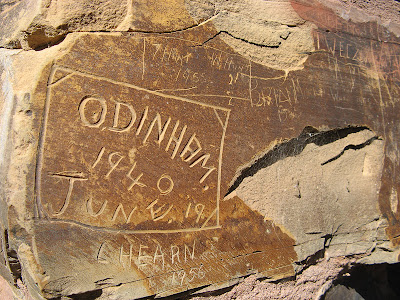
People had left their marks on the water tank at the Summit Camp, but at Grays Hut we found much older marks. There on one of the few remains of the original hut, on the stone chimney, people had scratched their names. Grays Hut is very new and clean, with a nice outside area.


Nearing the end of the hike, we faced this incredible hill, but were relieved to hear we didn't need to climb all the way to the top! Several kilometres on, at the road to Alligator Gorge, Lyn and Helen finished the trail. We had to hike a further one kilometre up the road to meet the bus, but were elated at the sight of the bus coming down the road. Apparently the driver thought it was too steep for the bus, but came out anyway! The next morning we got to see how steep it was when were driven back to our end spot for that day's hike, as the bus slowly laboured up the hills.

Read another's account (a Tale of Adventure, Exhaustion and Sheep) of hiking to the summit and beyond.

  • Distance: 23km
  • Hike time: 7.20am to 4.20pm
  • Clear, 25 degrees (maybe)


View map in full screen mode

Wednesday, July 18, 2007

No-one could eat that steak?!?

Here is some photos Hilary sent me. It should be noted that she did not eat all her steak, indeed she barely touched it... wasting resources just harms the environment... tsk tsk. Although Hilary would allege it was me who wouldn't share (I didn't order it!)


Yes, the plate is a full 30cm plate, which makes the steak about 'this big' (holding out hands at arms length...)


Melrose welcomes the cyclists and hikers


I look retarded, but apparently the incident at the time got the thumbs up


Fame and fortune, author photographed with the celebrities (who are still awaiting their fortune)


Check out the cover of this little book

Sunday, July 08, 2007

Robyn's Three Hour Walk

Murray Town to Melrose
Northern Guidebook, Maps 2.9-2.11

Robyn had other plans today, so she came up early on Friday and did this hike. It took her just three hours. At the end of the hike it started raining and she only had to run a very short distance to make it to the cover of a shopfront in the main street of Melrose. Groups take longer than one person to hike a distance, but even still, we thought this would be a short walk. But as it turned out, on the Saturday when we parked the cars at the end of Saturday's hike, to hike back to them, she discovered she had started at the wrong spot - about 4-5km north, at a point that was earlier planned to be the start of the hike. So although our hike would be short today, it wasn't going to be super short.

We've been seeing Mt Remarkable looming in the distance now for the past six hikes, today we hiked to it's base. It rises very dramatically against the plains that surround the eastern and southern sides of it.


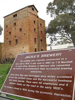
At the end of the day we missed a trail marker when hiking into Melrose, following the map instead, missing out on passing this wonderful old building in a back street.

  • Distance: 17km
  • Terrain: Mostly flat, mostly roads, some farmlands
  • Hiking time: 4 hours something approx


Saturday, July 07, 2007

Ruined Houses and Old Road Reserves

Block Nine Road (Wirrabara Forest) to Murray Town
Northern Guidebook, Maps 2.7-2.9

Today we bid farewell to Wirrabara Forest, heading up and out of the valley and across the plains towards the dramatic backdrop of Mt Remarkable.


Lots of old road reserves and ruins today - roads set out close together with small blocks. Extracts from a monument at the long defunct Murphy Town explain it well:

The widespread surveying of Homestead Leases or Workingman's Blocks took place during the 1880's and 1890's to increase the population of rural areas and assist workers to provide for their families. Most blocks were about 20 acres and many were spread throughout the district. More than 100 blocks were surveyed...


The purpose of the Blocks was to provide enough land to enable working men to grow fruit and vegetables, some grain crops, keep a cow or two and some poultry...


However, by the 1930's a combination of factors had brought about the demise of these Workingmen's communities. The spread of the rail system enabled the distribution of fruit from earlier ripening irrigation areas into the district and increased mechanisation of farming caused the loss of a large part of the casual labour market. So the Blockers and their families moved elsewhere to find work.


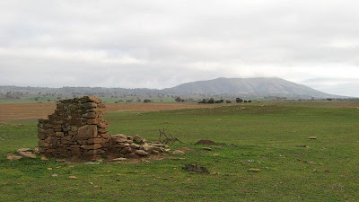
What was interesting about the homes was that they were clearly all built a long time ago and abandoned at a similar time, left untouched since. There was a high incidence of ruins which indicated that the rear of the house, that being the lean-to flat-roofed section, was build first, the front wall of the house consisting of a central door and no windows. This would have been to allow the construction of the more formal front two rooms of the house later, with a gabled or hip roof and verandah. It expresses the hope and dreams the settlers placed in their land, and that the land failed to meet these expectations.


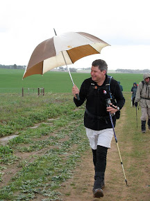
Robyn carried her umbrella today, after Leonie introduced her "hiking" umbrella last month. She didn't need it, it only rained a few brief moments. Jerry confiscated it at one point, after a light shower had started. Tut tut. The Walk Leader with an umbrella... this should be reported to the higher hiking authorities...

  • Distance: 17km
  • Terrain: Mostly roads, mostly flat/undulating
  • Hiking time: Approx 5 hours


Monday, June 11, 2007

Know Your ABC's?

Wirrabara Forest (old nursery) to Block Nine Road
Northern Guidebook, Maps 2.6-2.7

Do you know your abc's? I don't wish to name names (obviously), but some of us don't seem to. Each map of the guidebook shows a gradient profile along with the map, with alphabet letters to mark ridges and troughs. "No, no, surely we are here, at 'H'." No, no, no - ever so hopeful. 'H' marked the top of today's highest peak. We were only, well barely, at 'E'. Which left 'F' and 'G' still to pass, yet alone the long climb to 'H'. Then of course, there was the discussion about 'H' being the last hill. Well yes, kinda, the last significant hill would be more accurate. We still had to change maps, with numerous small hills - or undulations shall we say - before we made it to the next map, and yet another 'H' marking another peak. Although, I must say, this was, yet again, another long hill. A nice climb though, off of the ridge fire tracks we had been following for the past several days, and along a single file trail passing beside a creek. We had already had some rain, along the long ridge in the early arvo, immediately after lunch, but as the day wore on, so did the rain - getting heavier with each shower. By the end of the day's walk, in the pouring rain, we left another fire track to head up a hill - the fire track passed off along a contour seemingly in a different direction. But no, down the other side of the hill we rejoined the same fire track, pretty much at the same altitude as we had left it. Ha ha. Nice one Terry.

Today marked another curious moment. "Wow, I will be able to comment on your cooking after I have eaten this cookie you baked," Elizabeth said. Um, well, no, actually, even then you won't be able to comment on my cooking. And no, please don't shame your family name like that other person on the walk that suggested that I had purchased the cookies in a shop. Absolutely not! This was a secret recipe, handed down from my mother's mother, brought out on the treacherous seas from England. Using Colonel Light Garden's eleven secret herbs and spices - all I can share is the dried strawberries, a key ingredient. They came off the dried strawberry tree of course, the one in the old orange orchard we came by on the first day's hike. It had been my turn to provide the silver platter - a long standing tradition of the End-to-End 2 group, and one which I shan't go into great detail here, or indeed any detail at all. Since Hilary is taking her turn at the silver platter next month, and due to popular request, I have decided to bestow upon Hilary the recipe, including it's finer points, so we may enjoy the cookies again next walk. Various people, and they shall not be named here, came to my rescue this weekend. I shall not entertain any more discussion on the matter, you know who you are, and those that know me well know my incredible gift of memory so you guys can put two-and-two together.

I can't remember much more. Um, it rained, but it was all good. It wasn't cold or windy. Someone took photos of ants superimposed over people's faces. Mmm, good look that. Apparently ants appear in great numbers before rain, and then retreat once the rains come. What I didn't know was that they retreated into camera lenses for protection against the rain. Mmm... nothing else to mention. We probably gave Russell too hard a time though, but hey, welcome to SA and our club. Everyone welcome, do join us, we have no problem in pointing out any of your shortcomings. It's a burden bestowed upon us. A gift you might say.

Mt Remarkable looms, not for the next walk in July, but in August. Thirty steep kilometres!

I'd worked up an appetite today though, stopping off at both the Stone Hut bakery (fyi Stone Hut is a town) and the Golden North ice creamery in Laura on the drive home. But you don't care about that. That bakery though, it's akin to the Port Elliot bakery. If you ever pass by - stop. If you ever drive to the central Flinders, maybe go via Clare, then you can pass by - and stop for a few moments and enjoy the good bakery food.


  • Distance: 19km
  • Total time: 6.5 hours