A Long Hike
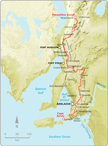
Myponga to Mt Compass
Southern Guidebook, Maps 2.4-2.6
A long walk for the first walk of the season - 21.8km. After 3 days of rain, a day with lots of brief showers, but no wind and about 20C. Tiring stuff.
![]()
Myponga to Mt Compass
Southern Guidebook, Maps 2.4-2.6
A long walk for the first walk of the season - 21.8km. After 3 days of rain, a day with lots of brief showers, but no wind and about 20C. Tiring stuff.
![]()
| Trail completed to date:
Estimates of the length of the Heysen Trail vary, see the trail length discussion (verging on a tedious bore). |
|

No comments:
Post a Comment