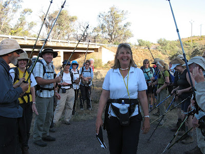
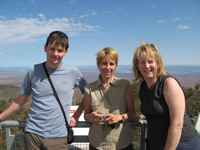
Robyn's Tail-End Charlie duty
Just a few hundred metres before the cars, we assigned Robyn the honourary position of Tail-End Charlie. It was tough, she had to deal with people threatening to jump off bridges and people tripping.
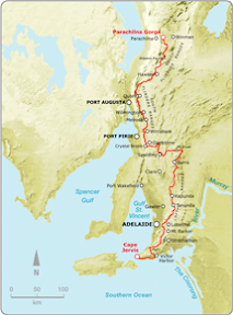
Mt Brown Creek to Woolshed Flat
Northern Guidebook, Maps 3.7-3.8
Robyn finished the Heysen Trail with this hike. She had joined the End-to-End 1 group in Quorn back in 2005, as they headed northwards to the end of the Heysen Trail. So as we neared the end of today's hike, we assigned her the position of Tail-End Charlie - the person who ensures no-on is left behind. As we walked under the road bridge near the cars, Tony and Dawn joined us to cheer Robyn on.
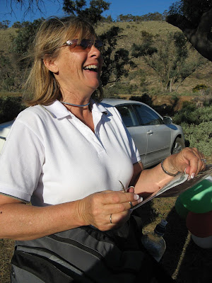
Thinking perhaps someone might challenge her achievement - you know who you are - in regards to an incident that took place beyond Burra, when after following a fence along treeless hills, up and down, we found ourselves in a valley where we had to hike up a hill, turn 90 degrees and return down the hill. A few of us, including myself, Robyn and George Adams, decided to shortcut along a creek, thereby avoiding this seemingly pointless hill. That night, George was given such a hard time about it, that in the following days he drove back out there, and climbed up this hill. So, back to today, Robyn was prepared for someone - we know who we are - to challenge her on this. So pulled out her scissors, and just nipped off one of the corners of her certificate.
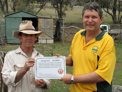
I really enjoyed today's hike, it was one of the best I've had this year. The day started with a 3km hike from the cars, parked near a homestead (by the gracious permission of the owner), to where we left the Heysen Trail the previous day. It was quite warm, but we had a quick shower of rain. Hiking towards the ominous Mt Brown, we came across a farmer and his family at a shed adjacent the trail. He'd been tipped off that we would be passing by, we had a plaque to erect adjacent a water tank that had been paid for by the End-to-End 1 group. Apparently, during that hike in May of 2005, David Beaton had come across this farmer working hard at erecting a shed. After some interrogation (as the farmer put it), it was agreed that when the shed was complete a tank could be installed that would serve the needs of the farmer, the CFS and hikers. So today we presented the plaque. To Bill's disappointment, it was not to be mounted today, that would wait until the farmer had erected a new fence. Bill didn't need to carry that cordless drill today after all...
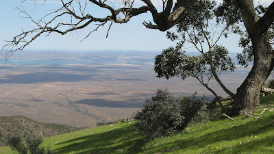
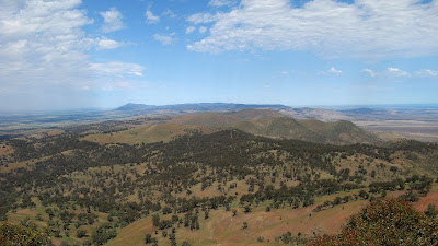
Hiking up Mt Brown was a challenge, not the least because we wandered a little off the trail. It was steep, but the views though were the best I have ever seen on the Heysen Trail - stunning!
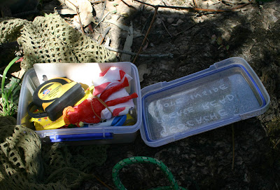
Lunch at the summit was well deserved. Bill and I set off with my new GPS unit to find a geocache, which we didn't find with the GPS at all, but with Bill's instinct (url cache details and comments).
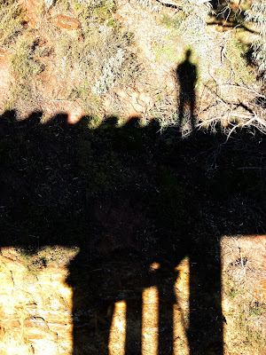
Hiking back down from Mt Brown we followed in the dust trail Graham left, glimpsing his shadow in the far distance when we rounded corners. The hike down was easy, the gradient and track was very different to the hike up from the south side - it was gentle gradients, zig-zagging down (or up?), and the track was clearly marked with signs every 200 metres.
The last 6kms or so was following Waukarie Creek back to Woolshed Flat. Very pleasant.
I tried a new technique with my GPS unit, fixing it to the top of my pack, so it was lying flat. Apparently it has superior reception like this (the same way you would hold it to read it), and indeed the map tracking was flawless today.
And on a personal note, these blog enties will probably take a little longer to appear in future, I resigned from my job today, taking up a new job with the marketing company Adcorp - promising to be much busier!
View photos as full page slideshow
More detailed stats now with my GPS unit.
Stats:
- Distance: 19.9km
- Moving average: 4.4km/h
- Moving duration: 4h 35m
- Stationary duration: 2h 44m
![]()

No comments:
Post a Comment