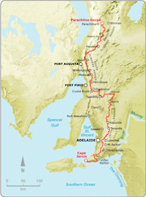
To see the fullness of the trail there's no better way to experience the trail but with a pack and tent.
8 days: Red Range to Parachilna GorgeNorthern Guidebook, Maps 5.5-6.8Spent the week out on the Heysen Trail, camping and hiking with Graham. We thought we might get away from the big group of End-to-End 2, make our own path for the week. We joined them on the final day's hike into Parachilna Gorge.
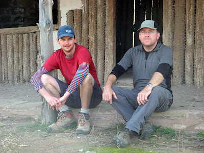 Me and Graham at Aroona Hut
On Saturday we drove up and did a scenic flight over the Flinders - taking in where we would be walking over the next 8 days. An amazing view, what a clear understanding we now had of the journey we were about to undertake! A few days later, hiking from Wilpena Pound, Graham waved at random planes who might have Bev on them (as it was their rest day). We thought it wise to stop that though, per chance a plane thought we needed assistance!
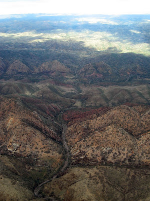 Bunyeroo Gorge
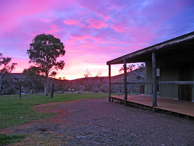
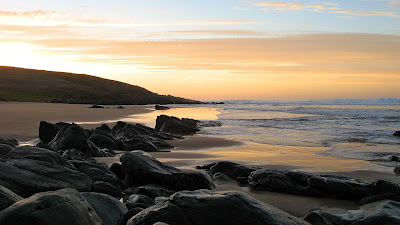
What I love about camping on the trail, is being able to witness what I consider some of the best times of day - sunrise and sunset. From Bridle Gap on Wilpena Pound's edge we were witness to not only a spectacular sunset but also the sunrise. However, it was quite cold, overnight temperatures ranged between -1.5C and 0C - but a fire each night kept us warm before bed.
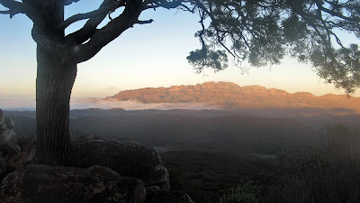 Sunrise from Bridle Gap with Elder Range in the background
Mid week we stayed in backpacker's accommodation at Wilpena, it was nice to have a shower, warm room and bed and a nice pub meal. The following day we detoured slightly to go past Old Wilpena Station, which used to be quite close to the trail, but now, I guess due to money making concerns, the trail gives it a wide berth.
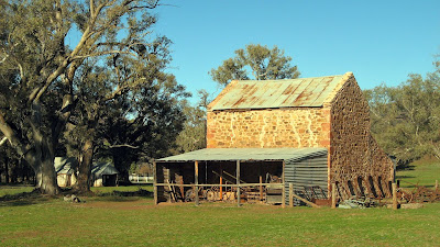 Old Wilpena Station
Of course, water is the biggest issue of this section of trail. When fully loaded so to speak, we were each carrying 4.5kg of water, which to say the least was quite heavy. We had to carry this much water to campsites with no water supply, or on the occasion we chose a random spot to camp. Camp E we called it, beside a creek, the name derived from the E symbol on the profile of that trail map.
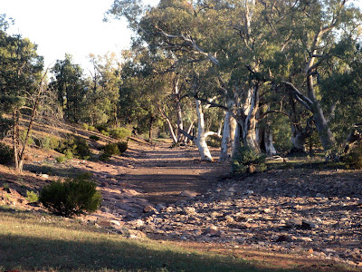 Camp E
It was a highlight to receive a gift of Ice Coffee and chips at Aroona Valley on the Friday near the end of the week. We met up with the main group for the first time, which was quite intense after a week on the trail largely by ourselves.
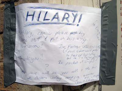 Hilary, bring us Ice Coffee!
Aroona Valley was a special place to me - I had camped here for the first time back in 2007, indeed, only my second time to this area of the Flinders. It's an amazing place, so quiet at the start and end of the day. My hopes for a spectacular sunrise were thwarted by a cloudy sky and fog over the Heysen Range.
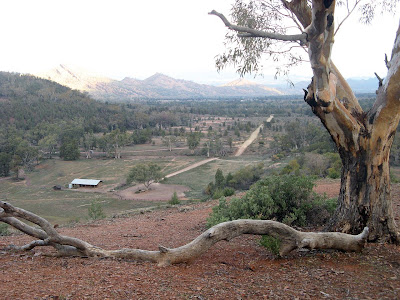 Aroona Valley
The first time I came to this part of the Flinders, back in June of 2005, I fell in love with hiking after doing the St Mary Peak loop. Despite a knee injury - a sign of things to come hiking - I was inspired to join a hiking group, which is how I came across the Friends of the Heysen Trail.
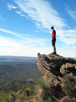 The climb up to St Mary peak
The final day we hiked an hour from Aroona Valley and waited at Pigeon Bore for 2 hours for the group. Here we walked the final 13km to the end of the Heysen Trail at Parachilna Gorge. It was quite surreal to watch the distance to the end of the trail decrease on my GPS unit. Walking this day was through quite an unknown area to me, and truly a stunning and fitting end to the trail.
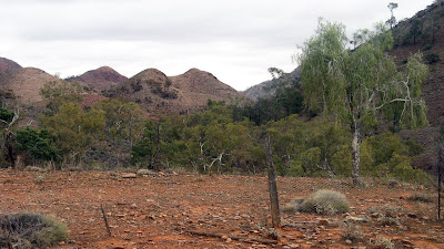 The final few kilometres
Well, some 580 photos later, the week was done as we climbed over the stile marking the end of the Heysen Trail. Nine of us were finishing today - Me, Ralene, Elizabeth, Hilary, Jim, Nikki, Bev, Rhonda & Gavin.
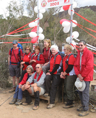
After a ride home from Richard and Nikki via the Parachilna Road, that night we celebrated at The Woolshed restaurant at Rawnsley Park. Various awards were handed out:
- Me - the Nelson Mandela Award for dealing with the South African problem
- Hilary - the Garmin GPS Award for walking the whole trail without having any idea where she was
- Ralene - the Shrinking Violet Award
- Bev - the Attracting the Waitress Award for her unique style at Laura
- Nikki - Award was for Determination
- Rhonda - the Ants in Her Pants Award for her two encounters
- Elizabeth - (I can't quite remember)
- Jim - (I can't quite remember)
- Gavin - the Mathematics Award for genius maths or for producing plausible & convincing answers
And Nikki sang us a special song -
Climb ev’ry Mountain (words and music by Rogers and Hammerstein, adapted by Nikki Birrell. With apologies to the Reverend Mother!)
Climb ev’ry mountain,
Hike high and low.
Follow ev’ry trail sign,
Ev’ry path you know.
Climb ev’ry mountain,
Ford ev’ry creek.
Follow all the leaders,
‘Til your legs grow weak.
Climb ev’ry mountain,
You’ll start at the KI ferry.
Somewhere, someday along the way
You’ll be led by a guy named Jerry.
Climb ev’ry mountain,
Descend into Deep Creek.
You’ll think you’ve reached the depths of Hell.
Of this I’ll no more speak.
Climb ev’ry mountain
From Bryan to Mount Brown.
And when you’ve climbed the loftiest peak
You’ll lunch... and then climb down.
Climb ev’ry mountain
Until their names don’t matter.
You’ll meet a group so debonair
They dine off a silver platter.
Climb ev’ry mountain
Meet Jez whose walking pace is a jog.
Beware of what you say or do
Or you’ll end up on his Blog!
Climb ev’ry mountain
With a fifty year old guy called Trevor.
At morning tea, Tim Tams are free
But they stay on your hips forever!
Climb ev’ry mountain
The Gavins, they come in threes.
One has a coach, number two has Christine
And three hammers nails into trees!
Climb ev’ry mountain
With the nuts from the fruit cake committee.
They aim to replace all the fat from your waist –
That you lost on the way. What a pity!
Climb ev’ry mountain
It’ll rain along the way.
The roads are boggy, the kilt gets soggy
But Barry will save the day!
Climb ev’ry mountain
Until your muscles harden
And then you’ll try and try again
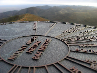
Until you’ve climbed MOUNT ARDEN!
Climb ev’ry mountain,
The going will be tough.
With blisters, bunions and broken bones
You’ll know when you’ve had enough.
Climb ev’ry mountain,
And when your legs, they fail
You’ll walk with Tail-end Charlie
Along the Heysen Trail.
A trail that will need
All the strength you can give.
Just one weekend a month
For as long as you live.
Climb ev’ry mountain,
Walk the Heysen Trail.
Sing-a-long with Simon,
Or you’ll end in Gladstone Gaol.
A trail that will need
You to walk with a ‘friend’.
Just one step at a time,
‘Til you reach Flinder’s end.
Climb ev’ry mountain,
Ford ev’ry stream.
Follow ev’ry rainbow
‘Til you find your dream.
I’ve climbed ev’ry mountain
From Cape Jervis by the sea.
I’m over the hill at Parachilna.
So what’s to become of me?
View photos as
full screen slideshowStats:


