The End
Melrose to Alligator Gorge Road
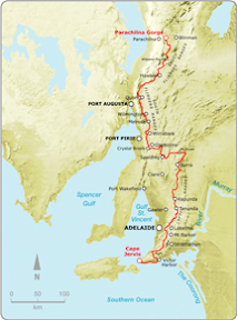
Northern Guidebook, Maps 3.1-3.3
No, not my end. Lyn and Helen finished the Heysen Trail today. Previously it has also been the end of people hiking the Heysen Trail - meaning it was so tough they gave up. Also, my end of the Heysen Trail is now in sight, with a detailed itinerary released today for next year's two weeks away, so I will finish the trail in August (2008).
It was a tough hike, harder than the Sea-to-Summit hike of a few weeks ago, climbing up to the summit of Mt Remarkable, then on to the road that leads into Alligator Gorge. The hike to the summit wasn't hard, 7km long but gently winding it's way up, but the 16km after that was tough!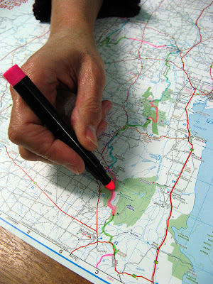
Lyn marks the final section off on her map
Also, the end of the trail is now in sight for me. I was to have completed 50.25% (let's call it 50%!) of the Heysen Trail after tomorrow's hike. But I was told the Heysen Trail was 1,197km long when last officially measured (re-routes would have varied that a little, give and take) around 2000 or so. I thought it was last officially measured at 1,144km... so this weekend I was to hike from 47% to 50% complete... but now with that new info, after Sunday's hike it would be just 48% complete. That may not sound too close to the end, but it is now just 1 year until I will complete the trail. Jerry handed around a detailed itinerary for our two weeks away next year (2008), one week's hiking in June, and another in August. So with the rest of the scheduled hikes for this year, a few extras, and the End-to-End 3 hikes between April and August, I will finish the Heysen Trail at Parachilna Gorge in August. Yay! That's not really so far away, heh?
As today was a long, tough hike, we started at 7am from Melrose, opting to get the bus to return us to Melrose at the end of the day. As it was, the 23km took us until 4.30pm to complete. I enjoyed starting early, we got to enjoy those few wonderful hours in the morning as the sun rose, with superb photos of Mt Remarkable and views over Melrose on the hike up to the summit. I needed to get a cover photo for the upcoming Trailwalker, so I took lots of portrait shaped photos on the hike up to the summit. Maybe I have something. I should really think more about these things in the three months leading up to each Trailwalker.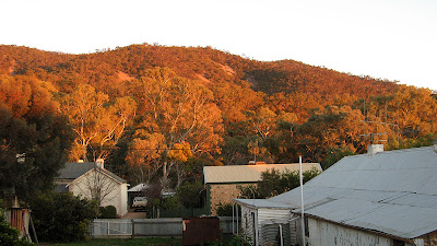
We walked across a few areas of screed, a nice word for rock fall really. Huge areas had succumbed to rock falls, but were relatively stable - if you can believe it - when a path had been flattened out across it. On one particularly large area, the sound underfoot was unsettlingly hollow. I stepped just off the edge of the flattened path to take a potential Trailwalker cover photo, and oh my goodness, it was very unstable just off the path. It's a wonder that the path is safe. It was in this section we also saw the remains of a light aircraft that had crashed on the mountain in heavy fog whilst descending to Port Pirie from Broken Hill. Everyone was so callous, they didn't even check the wreckage for survivors! What if this crash had happened just last night? Of course it hadn't, the wreckage has been there since the 1970's. I gather that the plane wreckage has been slowly moving it's way down this rock slide, breaking up more and more over time.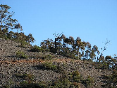
There were some very steep sections after the summit, one down a sharp valley and back up the other side. Magnificent views along Spring Creek through Webbs Cutting.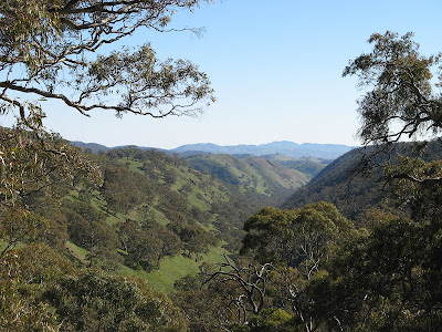
People had left their marks on the water tank at the Summit Camp, but at Grays Hut we found much older marks. There on one of the few remains of the original hut, on the stone chimney, people had scratched their names. Grays Hut is very new and clean, with a nice outside area.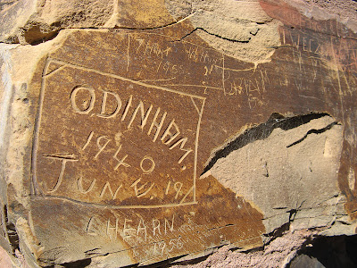
Nearing the end of the hike, we faced this incredible hill, but were relieved to hear we didn't need to climb all the way to the top! Several kilometres on, at the road to Alligator Gorge, Lyn and Helen finished the trail. We had to hike a further one kilometre up the road to meet the bus, but were elated at the sight of the bus coming down the road. Apparently the driver thought it was too steep for the bus, but came out anyway! The next morning we got to see how steep it was when were driven back to our end spot for that day's hike, as the bus slowly laboured up the hills.
Read another's account (a Tale of Adventure, Exhaustion and Sheep) of hiking to the summit and beyond.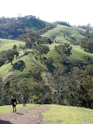
- Distance: 23km
- Hike time: 7.20am to 4.20pm
- Clear, 25 degrees (maybe)
View map in full screen mode
![]()

1 comment:
Hey Jez, we have just finished this walk, and I have to concur re the difficulty of the walk. I am kinda glad I did not read this blog entry b4 hand, as I may have been put off doing the walk altogether!!! Hard walk, but fantastic scenery. We had a perfectly clear sunny day and a pleasant 17 degrees. Has this walk been changed recently? We had to walk 26kms, just to add to the pain.
Love your photo's and one more question. Has it ever been considered to have the trail go through Alligator Gorge? Had I not had a bit of extra time to kill this last weekend I may have missed this stunning gorge.
Post a Comment