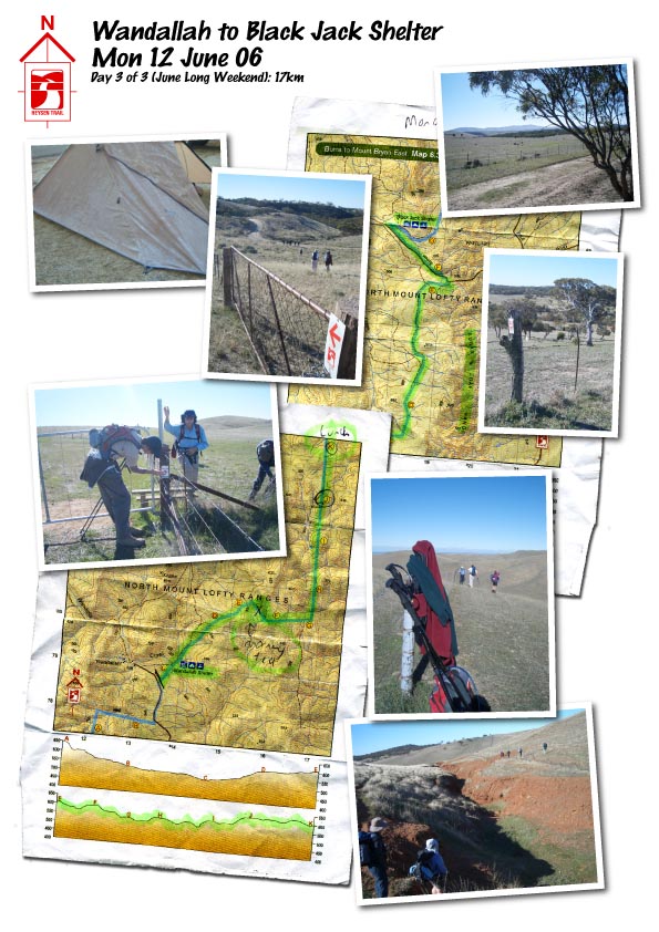
Wandallah to Black Jack Shelter

![]()
| Trail completed to date:
Estimates of the length of the Heysen Trail vary, see the trail length discussion (verging on a tedious bore). |
|
A note about the GPS maps appearing on this blog. Prior to September, 2007, all Google Maps are mash-ups, drawn on-screen. Initially, I favoured the satellite image as the determining where to draw the trail, but later I started to rely on the map view to determine where to mark the track - this being more accurate when satellite images would later be updated (the map and satelite often don't closely match up). As of September, 2007, all maps are generated from a GPS unit, so can be considered accurate (particularly when looking at the map view). Of course that doesn't stop me from wandering off the trail... |
Intro |

No comments:
Post a Comment