I'm not sure how the cows manouvered themselves along these tight sections of the trail. But evidently they did, and they were there for a while, manourvering themselves, and leaving us large, squishy, sloppy presents. We must have been glad of the gift, you can tell, cos so many of us managed to step in one. Or was it that you spent so much time avoiding stepping in one, that you eventually gave up and ended up stepping in many?
Today's 20km walk was through pastoral land, cows obviously, but most of the trail followed old tracks. This was all unknown territory to me, never having been through Inman Valley. It was all so green, it was hard to believe we hadn't had much rainfall. The corridor the tracks passed through were pleasant, lush really, although strangely overpopulated with cow patties. The vallies were spectacular to look across, the green, the areas of vegetation and pine plantation forest.
The wind had been so fierce the night before, at 4am it was difficult to imagine that it would calm down enough to make today's walk comfortable. The weather forecast was for a clearing day with light showers, I know, I checked it at 5am in the morning. The wind so so gustful that it kept waking me, so I checked the BOM's forecast on my phone. By morning it had settled a little, and increasingly so as the morning wore on. By the time we reached Inman Valley to meet the buses, it was even sunny! However the weather varied throughout the day, with short bursts of light rain, or horizontal heavy rain, warm sun and cold wind.
I don't have much else to write, my mind is too occupied with my holiday to Thailand in just 4 sleeps time? I think so...
I learnt a few things on this walk. Firstly, walking by oneself can be boring. Although, the boring factor might have come because it was a catch-up walk. So what I really learnt was that catch-up walks are boring. Why? Cos I could see where I was starting, and where I was ending. I knew the kind of scenery to expect. I had already been here and done that. Possibly though, I would enjoy a catch-up walk if I did it with other people. What did I think about during the walk? I pondered whether I enjoyed walking, or walking with people more.
I drove up to Burra Creek on Friday night. It was kinda planned, pencilled in you might say, but it was only late Friday afternoon I decided to do it. Packing at home, I thought I might like to go down to Ray's Outdoor store on West Terrace and buy myself and air mattress pumper-upper (that's the techinical name). Checking the web using my phone, oh how I love that, it was open until 7. Of course, I already have one of the pumper-upper devices, just I haven't seen it in so long I guess it isn't really mine anymore, especially since I have no idea where or with whom it is. I hurriedly packed, but when I got to Ray's it had clearly closed some time before. Mmm. I was later to realise I should have organised this during the week, it wasn't really just a comfort matter, my ribs ached and ached all Saturday from sleeping on that thin foam rollie mattress on the ground. Ah hindsight, what a wonderful gift, that no-one has. At least I now know what I might expect from some of my night's sleeps in Thailand, especially the hill tribe trek. I hope it has healed much more by then, can't believe my scooter accident was over three weeks ago when my ribs are still so sore.
Rode my bicycle, maybe 15 to 20km, on the roads from Burra Creek to the south along the bitumen road, then along the dirt roads across a low part of the hills into the next valley, then back up north to where the Heysen Trail is. This was ride was incredibly hard, one because it was uphill, and I didn't seem to consider this, as I got depressed about how hard it was to ride. Two, I had brought three litres of water for the walk, but forgotton to allocate any for the bike ride, when I needed much more! So I was rationing my water. The day was hot, predicted 24 degrees, but felt much hotter, 29 I think it was. Very dry and dusty. Woah. It was hot riding in the sun. Because of my low water, and hard riding, I cut short the ride to start the walk some 3kms west of Old Burra Road, on Koo-owie Road. I could come back later today when I collected my bike to finish the remaining 3kms back to Old Burra Rd, or simply leave it for some other time (what a bastard!) or just ignore it all together. My mood quickly lifted as I walked, I was much more comfortable doing this then riding. The experience with riding made me question whether I really want to ride the Mawson Trail or not, but also, if I did, I would need a new bike. My balls were hurting from the bumpy road riding. There was just no-where on the road to ride that was comfortable. But it's worth noting that I was riding alone, on an unexpectantly hot day, on a ride for some mental reason I thought would be quick, when it took me almost two hours, and on roads. Road riding is never as good as on a trail. And also I wasn't riding on the Mawson trail, so it seemed goal-less, and without a map. All in all, psychologically it wasn't ever going to be an easy ride.
Got lost a few times, seeing markers in the distance but forgetting to check the arrow direction on them when close up. Yep, I sure was very used to being led in a group, just following others! Had to back track a little, also being by myself it was disconcerting trying to find the next markers, sometimes I was a little nervous of where I was. At one stage, walking along a creek bed, I conceeded I had no idea where I was on the map, and at least I was walking downstream and which would lead out of the hills into the valley where my car was! Walking along the creek bed was my favourite part of the walk, but the rest of the walk was pretty ordinary. It was a quick walk, I never even stopped for lunch, it took 2 hours. When the others walked it, they were right, it was pretty boring walk.
Once I got back to the car, and checked my water supply by sight, rather than just feeling with my hand, I realised I still had 1.5L of my 3L remaining. Doh! I could have drinking so much more! So I drove back to my bike, parked, and walked back towards Old Burra Road. Walked to the top of the hill, and could see down to Old Burra Road. Having to walk to the end and turn around and return to the car, I just couldn't be bothered walking the last remaining 750 to 1000 metres. I took a photo. In the distance I could see that damn hill I walked down that had casused me so much knee pain!
The photos are so boring, is it because I was bored?
As an erratum to this blog entry (written months later), whilst making the Log Book, I noticed that the trail in this region where I got "lost" has been re-routed from that shown on the map. No wonder I could make so little sense of the map, and the trail seemed to go in a different direction! Later, when I climbed past the water pipe back to Old Burra Road, it was obvious then that the map and the trail differed, which might have served as a little discouragement to walk that 750m, again a re-route.
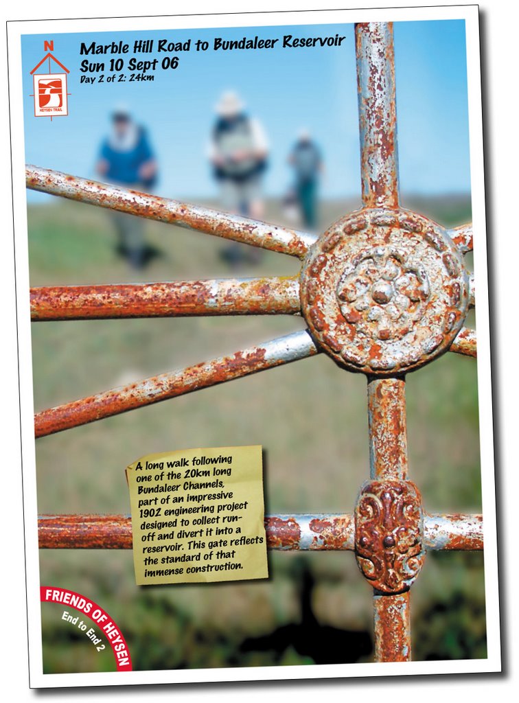
The channel was interesting, an engineering marvel. We looked at it's various features as we walked. It was impressive, imagining all the hard work that must have gone into building it a hundred years previously. The trail followed the channel, the channel falling at just 1 metre every mile. It followed the channel for some 20kms, and as we walked on our interest waned, we became keen to walk anywhere away from this damn channel! Today was in such contrast to yesterday, today it was breezey, not windy, and consistently warm and sunny. It was the hottest walking day I recall.
The network of channels was built between 1898 and 1902 to feed into the Bundaleer Reservoir, constructed to catch water to serve local towns. The channels harnessed the local rain run-off, directing it in huge concrete gutters. The earthworks and concrete work was amazing, little of it had cracked or been damaged. There were many smaller earth channels and concrete walls that fed into the larger channels, and there were several large overflow areas, a steel bridge that carried the channel over a river, a series of tunnels and even some creeks were directed not into, but underneath the channel. There were timber access bridges that crossed the channel at regular, and seemingly too often intervals, although many had been replaced by concrete bridges, the old timber sometimes piled up and rotting nearby. The gates associated with these bridges featured amazing detail, with large cast iron gate posts. The channels have been abandoned, not sure when, perhaps after the pipeline from Morgan was built in 1944, thanks to Google, but that's all I could really find out about the channels, except they were controversial when built. I wonder how effective they proved to be?
At the start of the day, before reaching the channels, I walked for 300 metres or so along the top of one of the water pipes from the Murray. I felt like a child balancing along it! Later, I wanted to walk along part of the channel floor, and perhaps also through one of the tunnels, but I was wary of my knees to I didn't undertake any such adventures down the sides of the steep channel! At Freshwater Creek weir, we had to walk around a flowing outflow, as the trail bridge had been washed away in the January floods. I wanted to climb over the sluice mechanism as there was a ladder on my side, so I shouted out to Raelene on the other side if there was a similar ladder on her side. Nope. I really wanted a ladder to be there, so I kept asking others, upsetting Raelene by not taking her at her word!
I had my photo taken at Freshwater Creek Weir, the point on the map that changed from the first map book to the second map book. This was the half way point of the trail. The weir, in which the channels and creek flowed into, was controlled by a sluice gate that led into another channel that followed parallel to the creek.
We found refuge from the sun in a shady spot further down the channel, and a couple of cyclists came our way along the shared Mawson Trail, having ridden from Bundaleer Forest that morning. They would continue riding until sunset before camping. They had ridden from Laura a few days previously, and planned to ride as far as they could until Wednesday. They were an inspiration, I want to ride the trail in blocks now and just camp at the end of each day, having ridden as far as I could that day. We shared some of our chocolate from our silver tray with them, I think they appreciated that. This was some of the last shade we saw. I drank my full two litres of water, the day before I had drank only one of my three litres, and had been too lazy to refill it the night before. I have learnt this lesson before - always take the full three litres of water each day! In the hot sun and unrelenting flatness of the walk we became weary of the channel. We enjoyed the spectacle of seeing the whole group holding up their trekking poles to ward off a swooping magpie.
Earlier in the day we had the funny event of Julie becoming stuck on a barb wire fence. The stiles here were modest, usually of only one tall step, and no poles to steady yourself with. Stepping over the fence seemed easier, but poor Julie got stuck!
We stopped at The Citadel in Clare for coffee and cake on the way home. It was my last End to End 2 walk for the season, I would be in Thailand for the last walk. It was a little sad to finish, I particularly enjoyed these weekends away.
One word sums up today. Wind. Today was one of those days when I wondered why I was walking the Heysen Trail. I just wanted the day to be over. The stone wall we walked along was fascinating, but walking along it all day, in a virtually straight line in that incredible wind? It just never seemed to end! We had to be wary of the fallen stones and the naturally stony ground (the source for the stone wall) to avoid any nasty falls.
The stone wall stretched from some 10km or so north of where the walk started, southwards 40km to near Clare. Running along the ridge of the hills, the dry wall was in various states of disrepair, some sections being relatively intact and quite tall, other sections being half that height, and other sections it appeared that local farmers had bulldozed the wall entirely. Although an impressive wall, it would have been hard to maintain and it had been replaced by a parallel convention fence.
For morning tea we sought refuge from the wind by sitting along the wall. Eating our snacks it was easy to forget just how windy it was above us! Walking on, just when the wind seemed it's worst, it would get even stronger. It wasn't particularly cold, being all rugged up with a scarf and gloves. In the windier sections we couldn't talk to each other much, more or less just shout at each other, and sometimes talk to the person immediately next to you.
The areas around the wall were littered with small quarries dug by hand to source the stones for the wall. For lunch, we were lucky enough to find one such sizeable quarry to get some shelter from the wind. The sun was warm out of the wind, without the wind it would have been a very pleasant day. Apparently this section of the trail was always windy, made worse by the fact that it follows the ridge of the hills, the area not surprisingly been marked for a wind farm.
The walk ended with some road walking, which was pleasant because there was little wind and we could talk to each other.
Tea that night was at a pub in Clare, Brinkleys, I think. A pleasant change from the Burra pub, not only were the staff friendly, but there were plenty of people around in this modern pub, and a more diverse menu. I particularly enjoyed a meal of chicken breast on sweet potato with a pesto and tomato salsa base. Yummo!
I had planned to set up tent in the Clare caravan park, but as Lyn, Nicky and Yvonne had a 5 bed cabin, Jeff and myself joined them. It was nice to stay inside with a bathroom and heater!
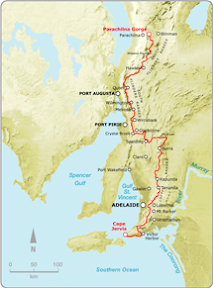
After a hike up St Mary's Peak in Wilpena Pound (Flinders Ranges, South Australia) in June 2005, I was inspired to join a hiking club. In April 2006, I joined the Friends of the Heysen Trail, and took up the challenge of walking the 1200km Heysen Trail (South Australia), from Cape Jervis, on the rugged south coast of the Fleurieu Peninsula, to Parachilna Gorge, in the Flinders Ranges.
"The Heysen Trail passes through some of South Australia's most diverse and breathtaking landscapes, traversing coastal areas, native bushland, rugged gorges, pine forests and vineyards, as well as rich farmland and historic towns."
I completed the Heysen Trail in August, 2008.
If you visit, please leave a comment on one of the blog entries, or email me a private message: jez@jeremyc.com. Thanks.
Blog entry links listed below in geographical order, rather than chronological order (blog entries on this site in chronological order). However, I did start at the beginning of the trail at Cape Jervis, and finished the trail at the end of the trail, at Parachilna Gorge, in August 2008. The maps below refer to the official guidebooks, 'S' referring to the Southern Guidebook, and 'N' referring to the Northern Guidebook.
A note about the GPS maps appearing on this blog. Prior to September, 2007, all Google Maps are mash-ups, drawn on-screen. Initially, I favoured the satellite image as the determining where to draw the trail, but later I started to rely on the map view to determine where to mark the track - this being more accurate when satellite images would later be updated (the map and satelite often don't closely match up). As of September, 2007, all maps are generated from a GPS unit, so can be considered accurate (particularly when looking at the map view). Of course that doesn't stop me from wandering off the trail...
Intro
I'm walking the trail with The Friends of Heysen Trail. I walk two weekends a month, which is 3 days, for the 8 or so months of the year when the trail is open, for 2006, 2007 and 2008.
The Hiking Club The Friends of Heysen Trail is a club whose primary focus is on maintaining the 1200km Heysen Trail, which stretches from Cape Jervis in the south of South Australia, to Parachilna in the Flinders Ranges. The club does organised hikes, including the End to End hikes. They have hikes almost every weekend, often having several hikes each weekend, some easy, others harder. Anyone can go along, the cost is $7 per walk (cheaper by pre-paying), but after having walked two walks you are expected to join the club, which is about $20 per year. The walk programme is available on the club's website, and also the guidelines as to what to wear and what to bring.
How the Walks Work
We usually meet somewhere near where the walk will end, sometimes in the city first to car-pool to that meeting location, then for $10 each we get taken by a bus to the start of the day's walk. From here, we break into smaller groups if need be, and walk back to the cars. The End to End walks involve about 6 hours and between 15kms and 25kms of walking. It's very well organised, and easy to join in (I joined without knowing anyone). There are always new people to meet, and everyone is always very friendly.
Two Groups
I'm walking with two smaller groups within the hiking club: End to End 3 (the 3rd group to start walking from one end to the other) started from the trail start, at Cape Jervis, in April 2006. This group has about 100 people in it across a broad range of ages. These walks are on one Sunday per month. End to End 2, the second group, was just south of Burra when I joined them, it only has about 20-25 people in it, many of whom are older, but they are still cool! We walk one weekend per month, meeting Saturday for a walk, staying overnight in a local town, then walking again on the Sunday, being too far from Adelaide to travel that far each day. I like this because you spend more time with people and we all share a meal together at a pub or restaurant on the Saturday night. Both groups are walking northwards.
 Today's 20km walk was through pastoral land, cows obviously, but most of the trail followed old tracks. This was all unknown territory to me, never having been through Inman Valley. It was all so green, it was hard to believe we hadn't had much rainfall. The corridor the tracks passed through were pleasant, lush really, although strangely overpopulated with cow patties. The vallies were spectacular to look across, the green, the areas of vegetation and pine plantation forest.
 The wind had been so fierce the night before, at 4am it was difficult to imagine that it would calm down enough to make today's walk comfortable. The weather forecast was for a clearing day with light showers, I know, I checked it at 5am in the morning. The wind so so gustful that it kept waking me, so I checked the BOM's forecast on my phone. By morning it had settled a little, and increasingly so as the morning wore on. By the time we reached Inman Valley to meet the buses, it was even sunny! However the weather varied throughout the day, with short bursts of light rain, or horizontal heavy rain, warm sun and cold wind.
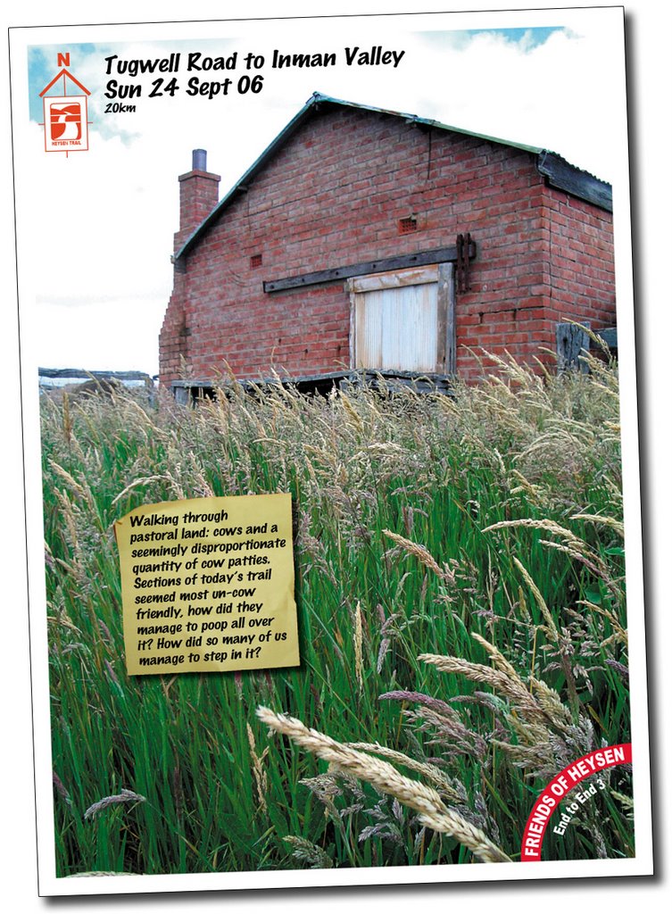


 A copy of the article that I wrote that appeared in the Friends of the Heysen Trail Spring 2006 magazine (