Sunday, August 17, 2008

The Heysen Trail - Complete

Yesterday I finished the Heysen Trail at Parachilna Gorge - a journey of some 1,200km from Cape Jervis. 64 days of hiking over the past 2 years.


Finished - August 16 2008 - at the end of the Heysen Trail at Parachilna Gorge

It seems a long time ago now, that fateful day when I started - April 30 2006. That morning was cold, I almost didn't bother getting up early.

It didn't go unnoticed today of my first End-to-End 2 weekend back in mid May 2006 when I hurt my knee on my first hike with that group. After six months or so of physio exercises, and lots of hike-bandaging and poles - well, let's just say I've come a long way since then.

It seems so surreal that I have finished the trail now, I can't imagine not doing it anymore. I might walk some days on the trail again with people, it may not be so easily done to untangle oneself from the trail. However I probably won't blog them here.

There may still some unfinished business looming with the Heysen Trail next year though, I'll get back to you on that one later. Secret squirrel.

In the meantime, plenty of hiking awaits elsewhere though, with plans to hike some three weeks in Tassie at the end of the year, not to mention plenty of other hiking around Australia. Keep a watch-out on my Training Camp blog - https://jez-hiking.blogspot.com. Also, got some plans coming to fruition soon to get back on the Mawson Trail - https://jez-mawson.blogspot.com. Next year watch out for a new blog, some travel plans might come to fruition - visit www.jeremyc.com early next year for the web address.

Sunday afternoon, we've already driven home (we left at 6am) and I'm sitting in the lounge room of my house watching the warm sunset colours in the garden. Surely I'm meant to be outside to experience this?

Saturday, August 16, 2008

A Final Week on the Trail

To see the fullness of the trail there's no better way to experience the trail but with a pack and tent.

8 days: Red Range to Parachilna Gorge
Northern Guidebook, Maps 5.5-6.8

Spent the week out on the Heysen Trail, camping and hiking with Graham. We thought we might get away from the big group of End-to-End 2, make our own path for the week. We joined them on the final day's hike into Parachilna Gorge.


Me and Graham at Aroona Hut

On Saturday we drove up and did a scenic flight over the Flinders - taking in where we would be walking over the next 8 days. An amazing view, what a clear understanding we now had of the journey we were about to undertake! A few days later, hiking from Wilpena Pound, Graham waved at random planes who might have Bev on them (as it was their rest day). We thought it wise to stop that though, per chance a plane thought we needed assistance!


Bunyeroo Gorge

What I love about camping on the trail, is being able to witness what I consider some of the best times of day - sunrise and sunset. From Bridle Gap on Wilpena Pound's edge we were witness to not only a spectacular sunset but also the sunrise. However, it was quite cold, overnight temperatures ranged between -1.5C and 0C - but a fire each night kept us warm before bed.


Sunrise from Bridle Gap with Elder Range in the background

Mid week we stayed in backpacker's accommodation at Wilpena, it was nice to have a shower, warm room and bed and a nice pub meal. The following day we detoured slightly to go past Old Wilpena Station, which used to be quite close to the trail, but now, I guess due to money making concerns, the trail gives it a wide berth.


Old Wilpena Station

Of course, water is the biggest issue of this section of trail. When fully loaded so to speak, we were each carrying 4.5kg of water, which to say the least was quite heavy. We had to carry this much water to campsites with no water supply, or on the occasion we chose a random spot to camp. Camp E we called it, beside a creek, the name derived from the E symbol on the profile of that trail map.


Camp E

It was a highlight to receive a gift of Ice Coffee and chips at Aroona Valley on the Friday near the end of the week. We met up with the main group for the first time, which was quite intense after a week on the trail largely by ourselves.

Hilary, bring us Ice Coffee!

Aroona Valley was a special place to me - I had camped here for the first time back in 2007, indeed, only my second time to this area of the Flinders. It's an amazing place, so quiet at the start and end of the day. My hopes for a spectacular sunrise were thwarted by a cloudy sky and fog over the Heysen Range.


Aroona Valley

The first time I came to this part of the Flinders, back in June of 2005, I fell in love with hiking after doing the St Mary Peak loop. Despite a knee injury - a sign of things to come hiking - I was inspired to join a hiking group, which is how I came across the Friends of the Heysen Trail.


The climb up to St Mary peak

The final day we hiked an hour from Aroona Valley and waited at Pigeon Bore for 2 hours for the group. Here we walked the final 13km to the end of the Heysen Trail at Parachilna Gorge. It was quite surreal to watch the distance to the end of the trail decrease on my GPS unit. Walking this day was through quite an unknown area to me, and truly a stunning and fitting end to the trail.


The final few kilometres

Well, some 580 photos later, the week was done as we climbed over the stile marking the end of the Heysen Trail. Nine of us were finishing today - Me, Ralene, Elizabeth, Hilary, Jim, Nikki, Bev, Rhonda & Gavin.


After a ride home from Richard and Nikki via the Parachilna Road, that night we celebrated at The Woolshed restaurant at Rawnsley Park. Various awards were handed out:

  • Me - the Nelson Mandela Award for dealing with the South African problem
  • Hilary - the Garmin GPS Award for walking the whole trail without having any idea where she was
  • Ralene - the Shrinking Violet Award
  • Bev - the Attracting the Waitress Award for her unique style at Laura
  • Nikki - Award was for Determination
  • Rhonda - the Ants in Her Pants Award for her two encounters
  • Elizabeth - (I can't quite remember)
  • Jim - (I can't quite remember)
  • Gavin - the Mathematics Award for genius maths or for producing plausible & convincing answers


And Nikki sang us a special song - Climb ev’ry Mountain (words and music by Rogers and Hammerstein, adapted by Nikki Birrell. With apologies to the Reverend Mother!)

Climb ev’ry mountain,
Hike high and low.
Follow ev’ry trail sign,
Ev’ry path you know.

Climb ev’ry mountain,
Ford ev’ry creek.
Follow all the leaders,
‘Til your legs grow weak.

Climb ev’ry mountain,
You’ll start at the KI ferry.
Somewhere, someday along the way
You’ll be led by a guy named Jerry.

Climb ev’ry mountain,
Descend into Deep Creek.
You’ll think you’ve reached the depths of Hell.
Of this I’ll no more speak.

Climb ev’ry mountain
From Bryan to Mount Brown.
And when you’ve climbed the loftiest peak
You’ll lunch... and then climb down.

Climb ev’ry mountain
Until their names don’t matter.
You’ll meet a group so debonair
They dine off a silver platter.

Climb ev’ry mountain
Meet Jez whose walking pace is a jog.
Beware of what you say or do
Or you’ll end up on his Blog!

Climb ev’ry mountain
With a fifty year old guy called Trevor.
At morning tea, Tim Tams are free
But they stay on your hips forever!

Climb ev’ry mountain
The Gavins, they come in threes.
One has a coach, number two has Christine
And three hammers nails into trees!

Climb ev’ry mountain
With the nuts from the fruit cake committee.
They aim to replace all the fat from your waist –
That you lost on the way. What a pity!

Climb ev’ry mountain
It’ll rain along the way.
The roads are boggy, the kilt gets soggy
But Barry will save the day!

Climb ev’ry mountain
Until your muscles harden
And then you’ll try and try again
Until you’ve climbed MOUNT ARDEN!

Climb ev’ry mountain,
The going will be tough.
With blisters, bunions and broken bones
You’ll know when you’ve had enough.

Climb ev’ry mountain,
And when your legs, they fail
You’ll walk with Tail-end Charlie
Along the Heysen Trail.

A trail that will need
All the strength you can give.
Just one weekend a month
For as long as you live.

Climb ev’ry mountain,
Walk the Heysen Trail.
Sing-a-long with Simon,
Or you’ll end in Gladstone Gaol.

A trail that will need
You to walk with a ‘friend’.
Just one step at a time,
‘Til you reach Flinder’s end.

Climb ev’ry mountain,
Ford ev’ry stream.
Follow ev’ry rainbow
‘Til you find your dream.

I’ve climbed ev’ry mountain
From Cape Jervis by the sea.
I’m over the hill at Parachilna.
So what’s to become of me?


View photos as full screen slideshow


Stats:

Sunday, August 03, 2008

The Missing Link

No, I didn't find ape-to-man fossils in the mud of Mt Crawford. I did the last catch-up hike today, I've now completed the Heysen Trail all the way from Cape Jervis to near Wilpena Pound.

Mt Crawford to Pewsey Vale
Southern Guidebook, Maps 3.9-4.2

Pretty cool stuff today, Wirra Wirra peaks is a real treat. Lots of farmland laneways too which were a bit special. And ruins of a quite large church on an isolated track, cool.

I've now completed 92% of the trail. Soon, the final episode - Red Range campsite (just south of Wilpena) to the end of the trail at Parachilna Gorge - some 92km.


Mt Crawford from Wirra Wirra Peaks


from Wirra Wirra Peaks


Stats:
  • Distance: 19.2km
  • Start time: 10.45am
  • End time: 2.40pm
  • Moving duration: 3h 01m
  • Stationary duration: 18m
  • Moving average: 6.3km/h
  • Overall average: 5.8km/h
  • Max speed: 11.7km/h

Sunday, July 20, 2008

The hardest two days on the H-Trail

Two hard days that Graham, Steve and I caught up - endless creek walking, and very windy ridgetop walking.

Dutchmans Stern to Mt Arden South campsite
to Buckaringa Gorge

Northern Guidebook, Maps 4.2-4.6


Sunrise at the Dutchman Hut

Saturday we set out from Dutchmans Hut. The previous night we had left a car at the end of the two-day hike, and we spent the night in this hut, just a short walk from the carpark in Dutchmans Stern Conservation Park. Very nice hut - electricity and very lean - but I woke up heaps of times that night because of some loud thing banging outside in the wind. Next morning, discovered it was a loose bit of wire holding one of the old doors on the back of the hut closed - damn it, it was so easy to fix. Beautiful sunrise in the east, lightning flashes in the west. But it was dry at that moment, so at 7.15 we set off. Oh my such amazing views.


Despite our heavy packs - complete with tent, cooking stuff, sleeping bags etc - we made it to Eyre Depot by 11.45, had an early lunch in the gorge further on - a much needed break, in the past 17km we had only had one break. The weather was holding off, amazing - cloudy, strangely warm day. The next 11km though took fooooreeever. It took us 4 hours to get to camp, making it there at 4.15, but gosh we were exhausted. The creek was beautiful, but so long. I had set up my GPS by pre-loading the trail onto it, so with amazing accuracy we could always tell by looking at the GPS if we were on the trail and exactly how far it was to the campsite (via the trail, not in a straight line), it was demoralising how slow our progress was. I slipped over at one point and got some lovely grazes, although for all the bandaging they are not very impressive. We went up the waterfall rather than the re-route, nothing huge but thankfully someone had tied a rope from the top to the bottom - otherwise it just wouldn't have been possible. Wouldn't want to do any of this creek in the wet.

After an exhausting walk we found the campsite, thankfully complete with shelter and water. After a nice warm dinner, it was off to bed for an early night.


Made fast progress up to Mt Arden where we were welcomed by the morning sun and an incredible wind. From here it just got madder and madder - the wind just got absolutely crazy. We had no care for the view, it was so much work to put one foot in front of the other to stay on the trail. At some gusty points we had to stop and do this weird crouch thing and prop-up with out poles to ensure we didn't get blown away. It was so funny yet seriously tiring. The end of the ridge couldn't come fast enough.

Made it back to the car at 11.30am, just 4 hours after leaving camp. A brisk walk at the end to avoid the impending rain, as I opened the car boot to put my pack in it started (while Graham and Steve madly tried to clamber over that weird stile on the sanctuary gate). Driving home it rained constantly, and on some roads there was water all over the road and beside it. I looked up the Bureau of Meteorology website and it had rained over 10mm near Snowtown (which is where there was just water everywhere).

Stopped off at Stone Hut bakery on the way home for some lunch with attitude, and Graham for his insolence got an extra helping of attitude.

A good weekend, but easily the toughest any of us have ever done on the trail.


View photos as full screen slideshow


Stats:
Saturday
  • Distance: 28.8km
  • Start time: 7.10am
  • End time: 4.20pm
  • Moving duration: 7h 01m
  • Stationary duration: 2h 32m
  • Moving average: 4.1km/h
  • Overall average: 3.0km/h
Sunday
  • Distance: 14.6km
  • Start time: 7.30am
  • End time: 11.20am
  • Moving duration: 3h 03m
  • Stationary duration: 45m
  • Moving average: 4.8km/h
  • Overall average: 3.8km/h

Sunday, July 13, 2008

Confessions

Uh... couple of confessions to make. Might have missed a couple of very short sections whilst doing some catch-up walks some time ago. All good now though.


So firstly, back on 17 Sept 2006 I walked from Old Burra Road to Worlds End... or so I said. In fact, it's a little complicated to explain, but I was 1.75km short of finishing that walk. I was standing at the top of the hill, looking down at the road where I was meant to end, and frankly I couldn't be bothered walking down there to turn around and walk back up the hill.

Hilary needed to catch-up from Webb Gap to Old Burra Road, so I joined in, and at the end of the walk Leonie walked with me the short distance up to the top of the hill so I could complete my missing piece.


Secondly, I repeated almost exactly the same scenario on the walk from Curnows Hut to Raeville, back on 6 May 2007. I caught this walk up on Sunday.


Sunday, June 29, 2008

The Cedars - Hans Heysen

I had thought a good idea before completing the Heysen Trail in August would be to walk the spur trail from Bridgewater to Hans Heysen's studio - The Cedars - near Hahndorf. The opportunity came up today whilst walking the Pioneer Womens Trail.

Hahndorf spur trail
Southern Guidebook, Map 3.3

I walked the Pioneer Womens Trail today, from Hahndorf to Beaumont, the first section being the spur trail of the Heysen Trail from Hahndorf to the main trail at Bridgewater. On our way we stopped at Hans Heysen's studio - The Cedars, near Hahndorf. It was early, so not yet open. I will return sometime before August to visit the studio and see some of the Heysen works on display there.

View the Pioneer Womens Trail blog entry on my Training Camp blog.

Sunday, June 22, 2008

Solstice

With it being the winter solstice, I camped out at a hut on Saturday night, and the following day hiked the End-to-End 3 hike.

Scotts Shelter to Mt Crawford
Southern Guidebook, Maps 3.8-3.9


As I have been walking the trail, I have been photographing huts and campsites for inclusion as a layer on the Heysen Trail Google Map. There are numerous alternative routes through the Mt Crawford sections of trail, and many camping and hut options. So it seemed easier just to spend a day driving and walking short distances to each one to take the photos.


Photographing huts

The final hut was Rossiters in Pewsey Vale, near Kaiserstuhl Conseration Park. I walked the short distance to the hut, and spent the night there.


Watching the sun set on the shortest day


Marcel's earlier log entry

The End-to-End 3 hike was pleasant, along forest trails and tracks. A good balance of ups and downs and spectacular views. The conservation park was a special treat.


A hike through Mt Crawford forest


View photos as full screen slideshow


Stats:
  • Distance: 20.6km
  • Start time: 9.32am
  • End time: 2.39pm
  • Moving duration: 3h 59m
  • Stationary duration: 1h 06m
  • Moving average: 5.2km/h
  • Overall average: 4.0km/h
  • Max speed: 8.3km/h

Sunday, June 15, 2008

84% of Heysen Trail complete

Just completed 7 days hiking on The Heysen Trail, now just 172km remains before I finish the trail in August of this year.

Buckaringa Gorge to Red Range Campsite


Rain disrupted the first two days, however the next five days went without a hitch:

I now have the following sections to complete:
  • June 22: Scotts Shelter to Mt Crawford (End-to-End 3)
  • July 19-20: The Dutchmans Hut to Mt Arden South campsite to Buckaringa Gorge
  • July 27: Mt Crawford to Pewsey Vale (End-to-End 3)
  • August 9-17: Red Range Campsite to Parachilna Gorge


Saturday, June 14, 2008

The Pound is here

Reached within close sighting distance of Wilpena Pound today. It has been on the horizon for a few days, but now it's immensity is before us.

Mt Little station to Red Range Campsite
Northern Guidebook, Maps 5.3-5.5


Wilpena Pound is a huge landmark for me in completing the Heysen Trail. The Pound is now just one day's walk away, and only 6 days from the end of the trail.


View photos as full screen slideshow


Stats:

  • Distance: 17.6km + 3km
  • Odometer: 139km
  • Start time: 9.40am
  • End time: 3.53pm
  • Moving duration: 5h08m
  • Stationary duration: 2h03m
  • Moving average: 5.0km/h
  • Overall average: 3.4km/h
  • Max speed: 12.7km/h

Friday, June 13, 2008

Lucky Miles


The spot for today was the rock pools in Wonoka Creek in Mayo Gorge - the filming location for the WA rock pools scenes in the movie Lucky Miles

Old Wonoka to Mt Little station
Northern Guidebook, Maps 5.2-5.3


Mayo Gorge - the filming location of scenes from Lucky Miles

We followed a creek all day, Wonoka Creek. Just 15 months ago the floods near Hawker had seen this creek up to 10 metres deep with raging water - evidenced by the huge trees deposited high up against standing trees and up on the bank. Typical of the Flinders, the creek was wide and flat, but high on the banks you could see just how wide this huge creek would have spread.

We had lunch at Mayo Hut, a great spot to spend the night on a bend of Wonoka Creek. Jerry stretched the start of lunch out so we could reach the hut, however after lunch it was just 1 kilometre of the trail before we left the trail and walked another 1 kilometre out to Mt Little station. Here was another good camping spot, including toilets, showers and a great camp kitchen and shelter.


View photos as full screen slideshow


Stats:

  • Distance: 15km + 1.7km
  • Odometer: 118.3km
  • Start time: 9.16am
  • End time: 2.34pm
  • Moving duration: 3h40m
  • Stationary duration: 1h37m
  • Moving average: 4.5km/h
  • Overall average: 3.1km/h
  • Max speed: 14.8km/h (that was a run btw)

Thursday, June 12, 2008

Special places

There are a few spots along the Heysen Trail that are very special, and this walk is along one of them - Yourabulla Range.

Jarvis Hill to Old Wonoka
Northern Guidebook, Maps 5.1-5.2


View from Yourabilla Range

There are just breathtaking views from the ranges over the Yilson Valley towards the Yappala Range in the west and The Wide Range and Red Range in the east and Wilpena Pound in the north.

Only 9km today, half along the range, half along the plain.


View photos as full screen slideshow


Stats:

  • Distance: 9.81km
  • Odometer: 101.6km
  • Start time: 9.23am
  • End time: 1.49pm
  • Moving duration: 2h50m
  • Stationary duration: 1h34m
  • Moving average: 3.5km/h
  • Overall average: 2.2km/h
  • Max speed: 7.6km/h

Wednesday, June 11, 2008

The Paranormals

The Normals, the Abnormals and the Paranormals. Today we had a handicapped start, the Paranormals first, followed by the Normals - the deciders of these names - and finally by the fastest hikers, the so-called Abnormals.

Partacoona Road to Jarvis Hill
Northern Guidebook, Maps 4.8-4.11


Like yesterday, the bus couldn't cross Kanyaka Creek, so two 4WDs ferried us the 6km to the start of today's hike - the end of yesterday's hike. It would be a long day - 26km - so the slowest hikers were ferried first so they could start walking.

Suprisingly, us Paranormals didn't catch the first yet slow group until they stopped 6km down the trail, we never even caught sight of them.

Not a lot to see today, well, the same view all day basically. Lots of marginal grazing land, old and rundown fencing demonstrating just how marginal the land is. A climb at the end of the bus on Jarvis Hill.


View photos as full screen slideshow


Stats:

  • Distance: 26.8km
  • Odometer: 91.79km
  • Start time: 8.58am
  • End time: 4.10pm
  • Moving duration: 5h35m
  • Stationary duration: 1h35m
  • Moving average: 4.8km/h
  • Overall average: 3.7km/h
  • Max speed: 8.9km/h

Tuesday, June 10, 2008

We really are OCD

Due to heavy rains the bus could only make it so far to today's end point, so we had to walk 5km past the bus to ensure we walked that section of trail - then had to return that 5km back to the bus.

Buckaringa Gorge to Partacoona Road
Northern Guidebook, Maps 4.6-4.8


Willochra Creek

Buckaringa Gorge was spectacular - huge surreal rockfaces. Willochra Creek was also a treat, flowing of course, so a tricky crossing and a climb up a rickety ladder.

A few falls today, muddy bums and so forth. The bus ride home was also a bit tricky with muddy roads.


View photos as full screen slideshow


Stats:

  • Distance: 21.5km + 2km
  • Odometer: 64.99km
  • Start time: 9.48am
  • End time: 4.17pm
  • Moving duration: 4h 33m
  • Stationary duration: 1h 55m
  • Moving average: 4.7km/h
  • Overall average: 3.3km/h
  • Max speed: 13.4km/h

Sunday, June 08, 2008

Most effort for least trail distance covered

Today the roads were wet. Our first attempt to reach the trail failed, so we made new plans. Having walked 9km to reach the trail, we made it just 450m along the trail before giving up and returning.

Mt Arden attempt
Northern Guidebook, Map 4.5


The climb towards Mt Arden

We had planned to walk from The Dutchmans Stern to Eyre Depot today, but yesterday due to recent heavy rains we changed it to the second planned day, from Eyre Depot to Buckaringa Gorge. This was so we could do the longest, hardest walk of the week before it got any wetter. Unfortunately it was just too wet for the bus on the muddy track, so after driving 17km from Port Augusta down a track towards Eyre Depot, we turned around. We formed a Plan B, go to the Arganells property - a 4WD, mountain biking and hiking property - to access the trail near Mt Arden, then walk to Buckaringa Gorge.

After three hours in the bus to reach that point, we hiked a short distance before having a morning break in the an old girl guides hall that had recently been moved on site.

We then set off through Hammersley Gorge - this area was just beautiful, stunning indeed. However by the time we had actually reached the Heysen Trail, some 9.5km later, we walked just 450m along the trail before giving up. The walk to the trail was ok, it was in sheltered valleys, but now we were to walk on an exposed ridge for the next 8km or so, it was just too windy and cold. We turned around and returned to the bus.

So we had spent 3 hours driving and 6 hours hiking to hike a mere 450m along the trail. Not much colouring in to be down in the trail guide this day.

The rain had got heavier, and the track wetter as we returned to the bus, so Monday's hike was canceled, pending better weather on Tuesday.


View photos as full screen slideshow


Stats:

  • Distance: 19.3km
  • Odometer: 24.59km
  • Start time: 9.46am
  • End time: 3.41pm
  • Moving duration: 4h 22m
  • Stationary duration: 1h 32m
  • Moving average: 4.4km/h
  • Overall average: 3.3km/h
  • Max speed: 14.1km/h

Sunday, June 01, 2008

7 days on the trail

No not me, I had seen Marcel last Sunday on my hike from Cudlee Creek, and 7 days later he had reached Marchalls Hut

Kapunda to Marschalls Hut to near Peters Hill
Southern Guidebook, Maps 5.1-5.3


Sunset from Marshalls Hut

This is my last independent hike on the trail I needed to complete. I now have a week away next week to go from the Dutchmans Hut (near Quorn) to Red Range (near Wilpena), two End-to-End 3 hikes from Scotts Shelter to Mt Crawford and onto Pewsey Vale, then a final week away from Red Range to the end of the trail at Parachilna Gorge. This weekend's hikes were the last bridge hikes to ensure I complete the Heysen Trail at the finish at the end of the trail and not later in the year at some obscure spot near Burra.

It was tough going, normally considered two walks, I did both on Saturday. I left my car near Peters Hill and rode my bike back to Kapunda, hiking back to Marschall Hut, near my car. I stayed there overnight, then Sunday morning hiked the short distance back to my car.


At Marschalls Hut I met Marcel, who has been hiking the entire trail from Cape Jervis since early May. He will continue northwards, completing the trail by July 12. We watched a fantastic sunset from the hut verandah, then we lit a fire inside from the firewood Marcel had collected. Very interesting guy, and good to hear he used the Google Map on the Heysen Trail website I made to work out his hikes and plan where to stay. I look forward to hearing from him when he finishes the trail to see how he went. A bit jealous really, a fantastic way to enjoy the trail.


View photos as full screen slideshow


Stats - Saturday:
  • Distance: 35.4km (15.7km + 19.7km)
  • Start time: 8.14am
  • End time: 3.34pm


Stats - Sunday:
  • Distance: 3.6km
  • Start time: 7.36am
  • End time: 8.27am
  • Moving duration: 37m
  • Stationary duration: 8m
  • Moving average: 5.7km/h
  • Overall average: 4.7km/h
  • Max speed: 8.5km/h


Sunday, May 25, 2008

Another day of breahtaking views

It seems hard to believe there could be so many different breathtaking views in a single day of hiking.

Cudlee Creek to Scotts Shelter
Southern Guidebook, Maps 3.7-3.8

Lots of forest walking today, and endless panoramas. Views are a challenge to capture in a photo, but I snapped a few I thought might look ok.


The view near Cudlee Creek

Today's walk was amazing, however it was interspersed with roads many of us would be familiar with from having driven along them, so it was like seeing something I have seen many times but from an entirely unimagined angle.


View photos as full screen slideshow


Stats:
  • Distance: 19.1km
  • Start time: 9.55am
  • End time: 3.35pm
  • Moving duration: 4h 21m
  • Stationary duration: 1h 17m
  • Moving average: 4.4km/h
  • Overall average: 3.4km/h
  • Max speed: 9.5km/h

Saturday, May 24, 2008

The moments that take your breath away

"Life isn't measured in the breaths you take, but in the moments that take your breath away."

Inman Valley to Myponga
Southern Guidebook, Maps 2.3-2.4

That was a quote I read this week, which suited today's walk. I don't know why I didn't expect much, but this walk was quite impressive. The views from Sugarloaf Hill were breathtaking - at first literally as I climbed up the hill, then I looked up to notice this!


View from Sugarloaf Hill

Myponga Conservation Park was equally cool to walk through. I had left my car near Myponga, and rode my bike back to Inman Valley. I really good ride too, flat-steep-undulating-downhill. Got some amazing speeds coming back down.


View photos as full screen slideshow


Stats:
  • Distance: 12km + 4km
  • Start time: 9.27am
  • End time: 1.13pm
  • Moving duration: 2h 38m
  • Stationary duration: 1h 0m
  • Moving average: 4.6km/h
  • Overall average: 3.3km/h
  • Max speed: 13.4km/h

Sunday, May 11, 2008

OCD of the Heysen Trail variety

I remember being told when I first starting hiking the trail, "you'll become obsessed with it you know, you'll plan your life around these weekends". Naturally, I didn't believe them, but now, it's what I tell others. They don't mention the highlighters though, the obsessive need to colour in where you have hiked, and to hike every last section of the trail so it can be coloured-in in the map books.


Peters Hill to South Tothill Ranges (Saturday)
South Tothill Ranges to Webb Gap (Sunday)

Southern Guidebook, Maps 5.4-5.7

This was one of those hikes, a catch-up hike, but not one we have missed yet. Put simply, End-to-End 3 will finish at Webb Gap in October, but I want to have hiked the entire trail when I finish at Parachilna Gorge on 16 August this year. So there are a few of the End-to-End 3 hikes I need to have completed prior to August, this being one of them.


It was two years ago, to the weekend, that I started with the End-to-End 2 group on the journey north, from Webb Gap. And it was here, on Sunday, that the gap between the End-to-End 3 group and End-to-End 2 group have been closed. I've got three walks to complete with End-to-End 3, in late May, late June and late July. And I have one walk from Kapunda to Peters Hill, and one final walk down south near Inman Valley - five walks in total I need to complete before August.

The Saturday hike was fairly ordinary, lots of road walking, although we had fun times. Hilary is in the same situation as myself, and the others had missed this walk earlier.


Saturday night we stayed in the caravan park in Riverton, a four-cabin caravan park. We booked all four cabins so the owners must have got the bubbly out on Saturday night. Meanwhile we ate tea at the Riverton Central pub, pretty average food, but a nice warm fire and cold beer.

Sunday morning we were treated to some surreal sights. As we drove across one valley into the next, dense fog filled the further valley and poured over in the one we were in. So cool to see, I have no idea why fog would form so densely in one valley but not the adjacent valley. This was nothing though to what we saw later, in the valley with the fog the sun rose and as it started to break up the fog it revealed a wave of fog dense fog that still lingered over the South Tothill Ranges. As the valley cleared completely of fog, the ranges looked like a wave of fog crashing on the valley floor - the ranges couldn't be seen at all.

During the car shuffle, we left six of the group standing the in fog, in the cold, with the sun still behind the dense fog, as we drove in our heated cars to the end of the walk and back (to leave three cars at the end, and one at the start).

Sunday's hike was quite unlike the previous day's hike, there were no road this time, just fire tracks. It was eerie to hike over and through the South Tothill Ranges in the dense fog, as those in front of us disappeared into the fog. By mid morning from the top of a hill we got the occasional glimpse through the passing fog to the valley below.


View photos as full screen slideshow


Stats:

Saturday
  • Distance: 17.6km
  • Start time: 9.10am
  • End time: 2.05pm
  • Moving duration: 3h 23m
  • Stationary duration: 1h 09m
  • Moving average: 5.2km/h
  • Overall average: 3.9km/h
  • Max speed: 9.4km/h
Sunday
  • Distance: 17.1km
  • Start time: 8.30am
  • End time: 2.00pm
  • Moving duration: 3h 39m
  • Stationary duration: 1h 51m
  • Moving average: 4.7km/h
  • Overall average: 3.3km/h
  • Max speed: 10.6km/h

Sunday, May 04, 2008

Party Bags

It was Carol's birthday, so come the morning break on this hike, out came some candles and vanilla slice - the birthday cake substitute (you can hardly carry a cake in your pack) - and party bags! Yep, Veronica brought party bags out for the occasion.


Melrose to Alligator Gorge Road (Saturday)
Alligator Gorge Road to Horrocks Pass (Sunday)

Northern Guidebook, Maps 3.1 to 3.5

Hilary piked out of this hike when End-to-End 2 came through, so she needed to catch up on this difficult hike (I did it with End-to-End 2 last August). So she gathered together some friends and somehow convinced me to join as a guide. A spectacular walk, so it wasn't a particularly difficult effort to convince me to join. Hilary's friends - of course - were hilarious. And somehow in the midst of all the hiking and laughter I think we might have convinced three or four of them to join in with the End-to-End 4 group that will start the Heysen Trail from Cape Jervis next year. I say convinced, but I think perhaps it was a case of them just catching the bug.


View photos as full screen slideshow


Stats:

Saturday
  • Distance: 22.9km
  • Start time: 7.50am
  • End time: 3.10pm
  • Moving duration: 5h 22m
  • Stationary duration: 1h 57m
  • Moving average: 4.3km/h
  • Overall average: 3.1km/h
  • Max speed: 7.8km/h
Sunday
  • Distance: 14.4km
  • Start time: 8.15am
  • End time: 11.55am
  • Moving duration: 2h 47m
  • Stationary duration: 45m
  • Moving average: 5.2km/h
  • Overall average: 4.1km/h
  • Max speed: 10.7km/h

Sunday, April 20, 2008

Walkers Follow Ridge

I was just thinking how well marked this section of trail was when I got lost. Just a little lost though, looking at my map and interpreting the contour lines I walked on, following the ridge line, soon passing another marker which stated "Walkers Follow Ridge". But sure enough, yup, I soon lost the trail.

Woolshed Flat to Quorn to The Dutchmans Stern
Northern Guidebook, Maps 3.8-4.2

Frankly, "Walkers Follow Ridge" sounds easier said than done. I mean, all well and good, but one needs to keep a good lookout for the marker that is going to lead you off the ridge. I found this one, but even though there were now lots of markers to lead me down into Pichi Richi Pass, there weren't quite enough for me (or I was too stupid for how few markers there were?). I soon got lost, the trail indistinguishable from the rocky landscape. Although, a fairly good spot to get lost, lots of distinct landmarks: Pichi Richi Pass on one side, containing a road and railway and a couple of distinct dirt roads, and Devils Peak and Mt Brown beyond. And I had my GPS, true. But lost I got, I knew where I needed to be and figured at some point I would wander across the trail and see it again, which of course I didn't. I found the trail again when it met up with railway.


Pichi Richi Pass with Mt Brown beyond

I was doing a catch-up walk that I missed late last year, when I had been training with Tim for the 50km Trailblazer event. I had 26km to cover, divided into two days. Short hikes. I parked my car in Quorn on Saturday morning, having got up with sun after camping in some random roadside clearing near the entrance to The Dutchmans Stern Conservation Park. Beautiful sunrise, so incredibly red.


Sunrise on The Dutchmans Stern

From Quorn, I cycled back along the bitumen road towards Port Augusta. The night before, while driving to my campsite, I had assessed how this morning ride would go. The last 5km would be almost entirely downhill and the start would be flat, however the middle section would by mildly uphill. Along a country road though, that uphill can seem to last forever. After resting a couple of times when I thought I was still on the flat section - but was in fact on the uphill section - I made it to the downhill section. I was aware that one can't make a very good assessment of hills whilst driving compared to the assessment one makes whilst cycling.

With my bike stored beneath a bridge on the Heysen Trail, I set off on my hike, up the hill to the ridgetop where I would later get a little misled on.

Once I reached the railway, I came across some sheep and lambs that had escaped the adjacent paddock. A tourist train was coming, I could tell this because of the collection of cars and people armed with cameras aimed at the railway that I could see at a distant level crossing. The sheep saw me, and started running away from me, to stop a safe distance and munch on grass again. Inevitably, I would come closer, and they would run on. This wasn't going to go well though, because the people, the cars and road lay ahead and on the right side, and there was a train coming from somewhere behind. Eventually the sheep chose to run onto the railway, where being animals and dumb, they then followed the railway. After much indecision, they left the railway choosing the road as their preferred fate. Of course that didn't last, they soon returned and ran across the railway - indeed back in my direction, evidently I wasn't quite so threatening compared to the other new threats - with a train just metres from them.


The first section of this day’s hike was good, I quite enjoyed the views, and didn’t really mind getting lost, given all the landmarks. The remaining two thirds of the day’s hike was ok, but pretty flat just following the railway. At one point though I came across a sign on a gate warning of bull camels. What did that mean? Later, when I heard sheep chatting away – this isn’t the first time I have seriously thought I heard sheep chatting and it turned out to be people – I came across the said camels. I think the sign mislead me, I was expecting to have to beat off a camel with a stick – hardly an issue though when the camels are being led by a guide and ridden by tourists.


Saturday night I moved campsite to beside the creek, a spot I couldn’t see in the dark the night before. There was no camping permitted inside The Dutchmans Stern Conservation Park – something I had anticipated. Camping is permitted beside the hiking hut, but this normally has no car access. The creek bank was good though, another awesome sunset.


Sunrise on The Dutchmans Stern

Sunday I did the second hike from Quorn to The Dutchmans Stern. Again, the cycling was easy – almost entirely downhill - it was more an issue of braking rather than peddling. The hike only took me two hours to complete, and initially I had planned to incorporate a loop walk around The Dutchmans Stern, but I didn’t feel that great and was eager to get back home early, being a four hour drive back to Adelaide.

With this catch-up hike complete, I now have only 1 more catch-up to do, scheduled with some friends for June. I have another 6 hikes to do to close the gap between Mt Crawford and Webb Gap (near Burra) so I can complete the entire trail at Parachilna Gorge on August 16 this year. I’ve got dates and people scheduled for all these too, except one, which will be easy to do sometime late in May.


View photos as full screen slideshow


Stats:
Saturday:
  • Distance: 16.8km
  • Start time: 9.00am
  • End time: 12.00pm
  • Moving duration: 3h 20m
  • Stationary duration: 35m
  • Moving average: 5.0km/h
  • Overall average: 4.3km/h
  • Max speed: 11.3km/h

Sunday:
  • Distance: 9.1km
  • Start time: 8.00am
  • End time: 10.10am
  • Moving duration: 1h 47m
  • Stationary duration: 22m
  • Moving average: 5.1km/h
  • Overall average: 4.2km/h
  • Max speed: 10.0km/h

Thursday, April 17, 2008

Exactly how long is the Heysen Trail?

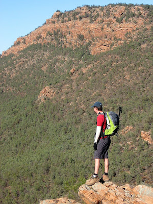
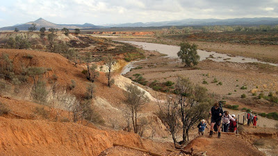
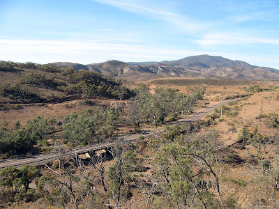
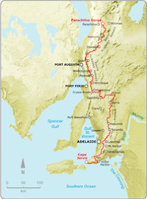
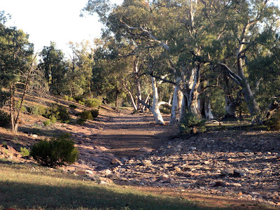
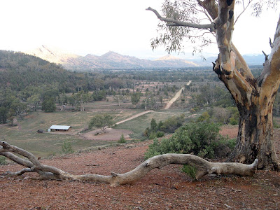
Estimates vary as to exactly how long the Heysen Trail actually is, although it is generally accepted that the trail is approximately 1,200km long. Is this really a good assumption to make though in calculating my percentage done and remaining?

This blog entry is tediously boring if you don't care how long the trail is. Really, what is the difference between whether it is 1,110km long or 1,200km long? Whichever it is, I and many others will walk the entire thing regardless. Don't say I didn't warn you... (although there is a short story about how someone walked 208 miles all the while measuring the distance with a short chain).

I've been keeping a tally of how much of the trail I have walked thus far - 740km, and have been regularly comparing this to the total trail length to see how much of a percentage I have achieved, and how much of a percentage I have left. I've accepted it as 1,200km, however now as I near the end, I don't want to have 10% still remaining on my last walk, only to discover 20km later at the trail head that the trail is shorter than 1,200km, or indeed longer!

Some sources claim the trail is 1,500km long - noted though only a few sources, few of which can be considered reliable. Some state this as the total distance including hills, ie the total steps taken - but this is simply not how you measure distances. Distances are measured from point A to point B via the given path assuming the land is dead flat.

The official guidebooks (published by the government Department for Environment and Heritage) give the distance each chapter covers, and this figure totals between 1,074km and 1,089km. Quite a bit smaller than the 1,200km they claim elsewhere in the introductions to the two guidebooks. However, I noted that some chapter estimates seem too low, particularly the last few chapters of the second guidebook.

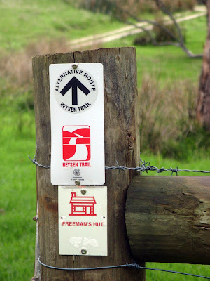
There are spur trails and alternate routes along some sections of the trail and some people have used this to explain the disparity in the trail lengths.

John Chapman (www.john.chapman.name/sa-heys.html) seems to have devoted quite some time to determining how long the trail is, deciding the trail is 1,144km long. He refers to two articles that appeared in the Friends of the Heysen Trail magazine and the Adelaide Bushwalkers' magazine that stated the trail to be 1,060km long (the claim isn't referenced with magazine issues/dates). He arrived at 1,144km by using two potentially reliable sources for 2/3 of the trail, and measuring the remaining 1/3 using maps. Assuming the two sources are reliable, the method for the remaining 1/3 will not have been as accurate. However, it does seem to indicate that the 1,200km figure is inflated.

I do have access to a GPS survey, apparently undertaken in 2000 by some university students surveying the entire trail. This file, infinitely more accurate than other sources, measures the trail as 1,175km in length, including spur trails and alternate routes. Using this data, the spur trails and alternate routes total 65km, so depending on which of the alternate routes you use (I favoured the ones I walked) this gives the total trail length as 1,110km. It should be noted though, that there have been numerous re-routes of the trail since 2000, although I would largely expect that in the give and take they would more or less equal out.

It seems very reasonable to me to use this 1,110km figure as the length. I had one further check to make to confirm it's reliability. I had determined that to date (23 April 2008), I had walked 740km of the trail. The figures used to calculate this come from my own GPS unit distances from each walk, and before August 2007, other people's GPS unit distances. With other people's GPS distances, I've tried to keep this as true as possible by rounding both down and up (within 0.5km) to try and keep an accurate overall figure.

Using the GPS survey, I calculated the length of my remaining walks - which amounted to 369km. Hesitantly, I did some sums: 1,110km minus 369km would equal the amount already walked, which in this sum was 741km - just 1 kilometre off my accumulated total of what I have walked. I was quite pleased that the sums added up so well - at first glance this double-check confirms the 1,110km length from the GPS survey. It does use 33% of that same GPS survey (ie the bit of the trail not yet walked) in the proof sums so probably can't be used as definitive proof, but I hope that as I walk the estimated remaining 369km, my own GPS unit will confirm this figure - hopefully to be 1,110km, plus or minus 1%? Which would be 1,099km to 1,121km. I'll report back in August this year my findings (if I still care). Of course, as already noted, re-routes might affect the overall trail length within a small percentage.

In the meantime though, and without going to the length Richard Norwood went to in 1633 to determine the size of the earth (he spent two years walking the 208 miles between London and York, all the while measuring with a short length of chain), I can use 1,110km figure to calculate my trail percentages, and hopefully not have to make any adjustments to that percentage as I near the end of the trail. I'm quite looking forward to getting into the nineties percentage points! So to date, I have completed 66% of the trail.

Note: the original GPS survey file is 17MB, so I can't offer it up here for cross-examination. It has however formed the basis of the KML file used in the Google Maps on the Friends of the Heysen Trail website.
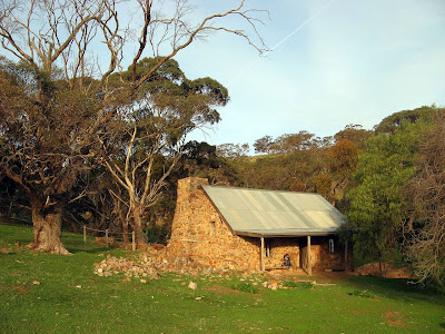
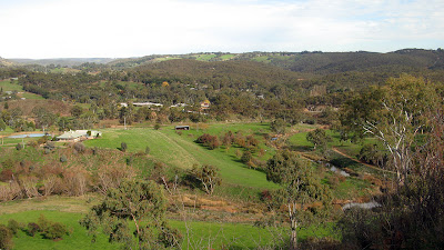
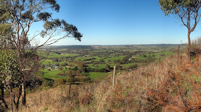
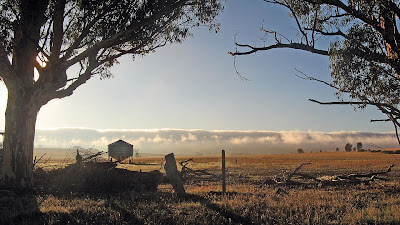
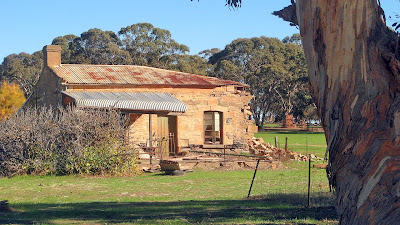
Monday, March 24, 2008

"At least I would die happy"

So said Kate as we discussed the way our heavy packs increased our chances of falling down the steep sides of the trail through Deep Creek. She was carrying all the snacks, including the lollies and chocolate, so, in her words, at least she would die happy if she fell.

Hiking 4 days along the Heysen Trail on the South Coast


I have hiked almost all this section before except a short 2km section I needed to do as a catch-up. Read the full blog entry on my Training Camp blog.