Sunday, June 10, 2007

Lines in the Sand

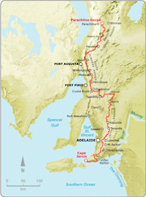
Beetaloo to Wirrabara Forest (old nursery)
Northern Guidebook, Maps 2.4-2.6
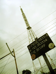
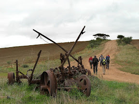
It was a tough walk. Some people, and at this point it would be worthwhile to retain some anonymity, were eager hikers today, walking far ahead of the others. Now the culture of this hiking club is all about walking at your own pace, however one should always stop to regroup at fences, gates, junctions etc. However, there just weren't many of these today, so the group got quite spread out as we each tackled the seemingly endless peaks and troughs. Our goal today was the tv tower on top of The Bluff, a distinct landmark in the South Flinders Ranges. We followed the ridge leading from the start of the Flinders Ranges, northwards. But each peak revealed yet another trough and peak, seemingly always falling short of the looming tv tower. As it turned out, the tv tower was enormous, and nearby were no less than three other towers, all dwarfed by this mammoth tower. So yes, back to those lines in the sand. They became a necessary control measure at these regrouping points. Us fast ones - opps, I mean, um, those fast ones - would spend some time waiting for the rest of the group to catch-up. Being eager hikers, they were keen to set off again, often not allowing those slower paced ones time to catch their breath. Normally, one would wait for the walk leader to start off again, but that's quite hard to do when you are so eager to keep walking! So eventually, Jerry was forced to draw a line in the sand at one of these regrouping points, which we were not permitted to cross. Russell, despite being the newbie in the group, thought nothing of crossing, sorry, accidentally falling, over the line. Sigh... so much to learn.
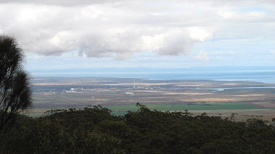


A long hike today, some 20km, difficult, but still fun. Lots of views over Port Pirie and the Spencer Gulf to Whyalla. After The Bluff, we had a steep hike back down to Wirrabara Forest. As predicted, by the time masters, Leonnie and myself, oh so humbly, we arrived at the appointed time of 5pm - just 15 minutes shy of sunset.


  • Distance: 20km
  • Total time: 7 hours


Saturday, June 09, 2007

Colouring-in Between the Lines

Bowman Park to Beetaloo
Northern Guidebook, Maps 2.1-2.3

Russell joined us for the first time today. He was late, let the record show. Yes Russell, it does indeed take more than two hours to drive from Adelaide to Laura. But to be fair, he has only been here in Adelaide for a couple of months, having moved down from Brisbane. I've got one word for you Russell - whereis.com.au. Anyway, looking rather relieved, he did eventually find us at Bowman Park, near Crystal Brook, at the start of today's walk. Hilary took him under her wing, carefully instructing and guiding him over the weekend in the art of correctly colouring in your guidebook - the record of your achievements along the Heysen Trail. Hilary certainly is the master of this, carefully packaging her guidebook in plastic, so those rains we had on Monday's walk didn't smudge and wash away all that hard work. It is a fine art, one must select the appropriate colours, not just any old highlighter will do. One must also ensure that each subsequent day uses a different, and just as appropriate colour. Myself and Hilary were quite concerned one night, unable to recall the distance we had walked, which could have resulted in a rather a sleepless night, Leonie came to our rescue and was able to put our minds at rest by phoning around amongst the other hikers to find an accurate recording of the distance traveled. These important facts are all part of the colouring-in of one's guidebook. Whilst Leonie spent some time ridiculing us about our colouring-in, more than one of us have caught her out through her carelessness - there has been the odd finger stained with a mark from a highlighter. There seems to be no doubt that she is a closet colourer.

Today we finally entered the South Flinders Ranges. I think I have claimed that before, but this time it is true. We hiked alongside a creek, and once we had decided upon a nice spot to rest for a quick snack, we settled down. However Bev did not approve, and we were forced onwards to find a suitable spot with logs to sit on. Though, I shouldn't diss Bev (yet I just did), with several others she came to my rescue on Monday's hike. But more about that later.

Not many photos today.


  • Distance: 16km
  • Total time: I can't remember


Sunday, May 27, 2007

The Rhinestone Cowboy that went too far

Mt Compass to Kyeema Conservation Park
Southern Guidebook, Maps 2.6-2.8

Simon has a habit of singing as he walks. I guess you can't deny him that right. Doesn't mean you should either enjoy it or endure it - especially when his chosen theme for the day is country songs. American, but still, country and western... urgh. Thankfully he didn't seem to know many, and those he did he knew very little of, and he didn't seem to be getting much encouragement.

Well worth walking up along the short - but steep - spur trail to the peak of Mt Magnificent. Simon played his bagpipes at the peak, roll your eyes, actually, no, unroll your eyes, I don't mind his bagpipes. An adrenalin rush coming back down, I ran, yes, you read correct, I ran down, proving how much better my knees are this hiking season.

After discussions with another (who will not be incriminated here) about the activities that took place at the dubious looking Kuitpo Community - it had all the appearance of a cult hide-out. Think guns and terrorists, or at least churches and silly games. It was none of the above, I googled it, it's a drug and alcohol rehab facility with a fairly long history. Now that's cool. Glad I waved at that guy and he was too far away to see my questionably expression.

We escaped the bulls atop the hill near Blackfellows Road and walked onto the end of the walk. Here, just before the end, we set ourselves up in two lines, and led by Simon's bagpipe efforts we marched in to the other waiting hikers. Simon really got a showing this walk, heh? Finished off with some birthday cake for Jerry's 50th. Nice one.


Sunday, May 13, 2007

Fast Tracking

Locks Ruin to Bowman Park
Northern Guidebook, Maps 1.8-2.1

Today was a day with fast results. Finally, after many kilometres travelling from east to west, the trail again returned northwards, heading into the South Flinders Ranges. And much of the day was following parallel to two railways, an old, dismantled railway, curving sharply around the landscape in cuttings, and a second, straighter and flatter railway - the newer of the two - with frequent trains passing destined for Sydney or Perth. There was some discussion, perhaps the Heysen Trail should have followed this old railway - in the cuttings, rather than the adjacent roads. That would be more better, a bit of history as one imagined what once was.


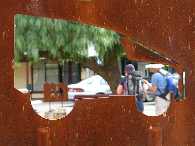
Again, we passed down a mainstreet. This really has been unheard of before this weekend. Today, the main street of Crystal Brook. A few curious, but cool, iron sculptures with a little bit of history. The odd monument to join them.


Passing by the dry, so-called 'crystal brook', we left the town via the golf course, heading for Bowman Park. On a quiet dirt road we found a little oasis, an old, albeit rather dilapitated house, set carefully next to the 'crystal brook', a dam creating a wonderully reeded wet land.

After passing another hut, this time Bowman Hut, a rather modern well-facilitated hut, we reached Bowman Park. After a nice chat with some locals, Bill brought out his journal, a compilation of photos and text - magnificent photos showing landscapes and incredible detailed wildlife close-ups, all well lit and composed - how I love a good photographers work!