Wednesday, July 18, 2007

New Blog for 'Off the Trail' Hikes

I've decided to put all my Off the Trail experiences onto a separate blog, to ensure this blog remains dedicated just to The Heysen Trail. I expect to be doing some extra hiking now off the Trail, here and interstate. I guess it shows a transition that has taken place for me, from just hiking the Heysen Trail to now exploring hiking trails elsewhere too.

New blog link: https://jez-hiking.blogspot.com/

Sunday, July 08, 2007

Robyn's Three Hour Walk

Murray Town to Melrose
Northern Guidebook, Maps 2.9-2.11

Robyn had other plans today, so she came up early on Friday and did this hike. It took her just three hours. At the end of the hike it started raining and she only had to run a very short distance to make it to the cover of a shopfront in the main street of Melrose. Groups take longer than one person to hike a distance, but even still, we thought this would be a short walk. But as it turned out, on the Saturday when we parked the cars at the end of Saturday's hike, to hike back to them, she discovered she had started at the wrong spot - about 4-5km north, at a point that was earlier planned to be the start of the hike. So although our hike would be short today, it wasn't going to be super short.

We've been seeing Mt Remarkable looming in the distance now for the past six hikes, today we hiked to it's base. It rises very dramatically against the plains that surround the eastern and southern sides of it.


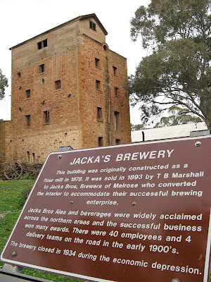
At the end of the day we missed a trail marker when hiking into Melrose, following the map instead, missing out on passing this wonderful old building in a back street.

  • Distance: 17km
  • Terrain: Mostly flat, mostly roads, some farmlands
  • Hiking time: 4 hours something approx


Saturday, July 07, 2007

Ruined Houses and Old Road Reserves

Block Nine Road (Wirrabara Forest) to Murray Town
Northern Guidebook, Maps 2.7-2.9

Today we bid farewell to Wirrabara Forest, heading up and out of the valley and across the plains towards the dramatic backdrop of Mt Remarkable.


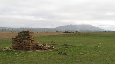
Lots of old road reserves and ruins today - roads set out close together with small blocks. Extracts from a monument at the long defunct Murphy Town explain it well:

The widespread surveying of Homestead Leases or Workingman's Blocks took place during the 1880's and 1890's to increase the population of rural areas and assist workers to provide for their families. Most blocks were about 20 acres and many were spread throughout the district. More than 100 blocks were surveyed...


The purpose of the Blocks was to provide enough land to enable working men to grow fruit and vegetables, some grain crops, keep a cow or two and some poultry...


However, by the 1930's a combination of factors had brought about the demise of these Workingmen's communities. The spread of the rail system enabled the distribution of fruit from earlier ripening irrigation areas into the district and increased mechanisation of farming caused the loss of a large part of the casual labour market. So the Blockers and their families moved elsewhere to find work.


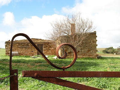
What was interesting about the homes was that they were clearly all built a long time ago and abandoned at a similar time, left untouched since. There was a high incidence of ruins which indicated that the rear of the house, that being the lean-to flat-roofed section, was build first, the front wall of the house consisting of a central door and no windows. This would have been to allow the construction of the more formal front two rooms of the house later, with a gabled or hip roof and verandah. It expresses the hope and dreams the settlers placed in their land, and that the land failed to meet these expectations.


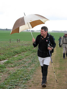
Robyn carried her umbrella today, after Leonie introduced her "hiking" umbrella last month. She didn't need it, it only rained a few brief moments. Jerry confiscated it at one point, after a light shower had started. Tut tut. The Walk Leader with an umbrella... this should be reported to the higher hiking authorities...

  • Distance: 17km
  • Terrain: Mostly roads, mostly flat/undulating
  • Hiking time: Approx 5 hours


Sunday, June 24, 2007

Ocean Over the Sand Dunes?

Kyeema Conservation Park to Dashwood Gully Road
Southern Guidebook, Maps 2.8-2.10

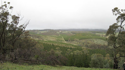
Lots of forest today. Or perhaps more accurately, what was once forest. Now people live in that forest, sleep on it, and put their trail marker signs on it. What I mean is felled forests, the timber long gone and made into building materials and products, all that was left were some stumps, a few areas of fresh plantings, and lots of sandy tracks. Climbing a couple of undulations - yes undulations, not hills - it was so sandy it felt like we would reach the top and see the ocean and smell the salt air. Alas, no ocean to be seen.
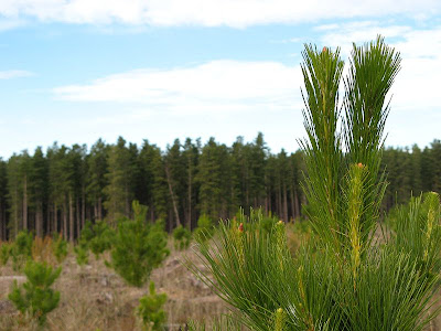


We saw forest too, the living variety rather than the cleared. Today we mainly followed tracks through the forests. We did see a hot dog stand. Seriously. Out there in the boonies, amongst the forest trees, on a wide track. Yep. Oh, but to be more accurate, there were many campers around it, and horses, cars, horse floats and so forth. A weekend horse riding event of some sort.

I've graduated to the fast group. I think my friends in the second group are upset. I don't think they will accept me back now. I've never walked in the fastest group in End-to-End 3 before, I don't know why particularly, just that I didn't during 2006, so I didn't think to in 2007. But of course, now I well know, without any knee probs and with improved hiking and general fitness, fast is my style. Just to let you guys on the outer in, with 100ish people on this walk - indeed 120 today - this allows for that 120 to be divided into 4-5 smaller manageable groups. They all set off at different times, so they can stay separate. So obviously, a fast group is sent forth first. Today, we had about 15 in our group, and we set a good pace. But it was an easy walk, 19.5km, with almost no hills whatsoever. Seriously, a couple of mild undulations, but not hills. We were done by 1.45pm.

  • Distance: 19.5km
  • Time: 4.5 hours or thereabouts
  • Gradient: flat
  • Terrain: mostly tracks, some sandy