Sunday, June 01, 2008

7 days on the trail

No not me, I had seen Marcel last Sunday on my hike from Cudlee Creek, and 7 days later he had reached Marchalls Hut

Kapunda to Marschalls Hut to near Peters Hill
Southern Guidebook, Maps 5.1-5.3
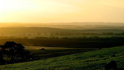

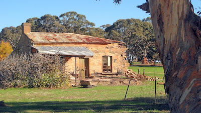
Sunset from Marshalls Hut

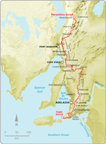
This is my last independent hike on the trail I needed to complete. I now have a week away next week to go from the Dutchmans Hut (near Quorn) to Red Range (near Wilpena), two End-to-End 3 hikes from Scotts Shelter to Mt Crawford and onto Pewsey Vale, then a final week away from Red Range to the end of the trail at Parachilna Gorge. This weekend's hikes were the last bridge hikes to ensure I complete the Heysen Trail at the finish at the end of the trail and not later in the year at some obscure spot near Burra.

It was tough going, normally considered two walks, I did both on Saturday. I left my car near Peters Hill and rode my bike back to Kapunda, hiking back to Marschall Hut, near my car. I stayed there overnight, then Sunday morning hiked the short distance back to my car.
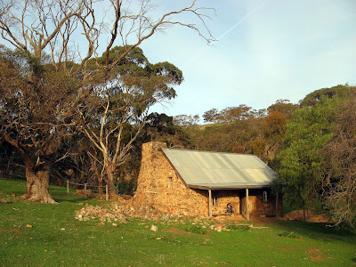


At Marschalls Hut I met Marcel, who has been hiking the entire trail from Cape Jervis since early May. He will continue northwards, completing the trail by July 12. We watched a fantastic sunset from the hut verandah, then we lit a fire inside from the firewood Marcel had collected. Very interesting guy, and good to hear he used the Google Map on the Heysen Trail website I made to work out his hikes and plan where to stay. I look forward to hearing from him when he finishes the trail to see how he went. A bit jealous really, a fantastic way to enjoy the trail.


View photos as full screen slideshow


Stats - Saturday:
  • Distance: 35.4km (15.7km + 19.7km)
  • Start time: 8.14am
  • End time: 3.34pm


Stats - Sunday:
  • Distance: 3.6km
  • Start time: 7.36am
  • End time: 8.27am
  • Moving duration: 37m
  • Stationary duration: 8m
  • Moving average: 5.7km/h
  • Overall average: 4.7km/h
  • Max speed: 8.5km/h


Sunday, May 25, 2008

Another day of breahtaking views

It seems hard to believe there could be so many different breathtaking views in a single day of hiking.

Cudlee Creek to Scotts Shelter
Southern Guidebook, Maps 3.7-3.8

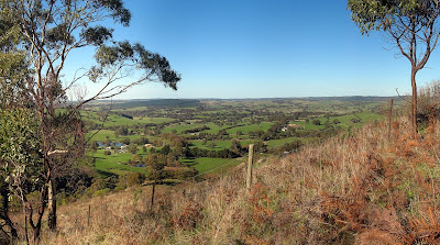
Lots of forest walking today, and endless panoramas. Views are a challenge to capture in a photo, but I snapped a few I thought might look ok.


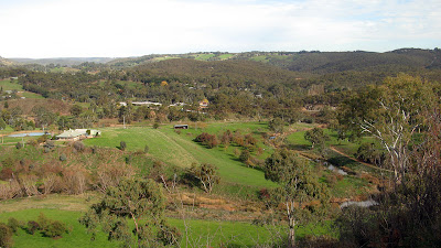
The view near Cudlee Creek

Today's walk was amazing, however it was interspersed with roads many of us would be familiar with from having driven along them, so it was like seeing something I have seen many times but from an entirely unimagined angle.


View photos as full screen slideshow


Stats:
  • Distance: 19.1km
  • Start time: 9.55am
  • End time: 3.35pm
  • Moving duration: 4h 21m
  • Stationary duration: 1h 17m
  • Moving average: 4.4km/h
  • Overall average: 3.4km/h
  • Max speed: 9.5km/h

Saturday, May 24, 2008

The moments that take your breath away

"Life isn't measured in the breaths you take, but in the moments that take your breath away."

Inman Valley to Myponga
Southern Guidebook, Maps 2.3-2.4

That was a quote I read this week, which suited today's walk. I don't know why I didn't expect much, but this walk was quite impressive. The views from Sugarloaf Hill were breathtaking - at first literally as I climbed up the hill, then I looked up to notice this!


View from Sugarloaf Hill

Myponga Conservation Park was equally cool to walk through. I had left my car near Myponga, and rode my bike back to Inman Valley. I really good ride too, flat-steep-undulating-downhill. Got some amazing speeds coming back down.


View photos as full screen slideshow


Stats:
  • Distance: 12km + 4km
  • Start time: 9.27am
  • End time: 1.13pm
  • Moving duration: 2h 38m
  • Stationary duration: 1h 0m
  • Moving average: 4.6km/h
  • Overall average: 3.3km/h
  • Max speed: 13.4km/h

Sunday, May 11, 2008

OCD of the Heysen Trail variety

I remember being told when I first starting hiking the trail, "you'll become obsessed with it you know, you'll plan your life around these weekends". Naturally, I didn't believe them, but now, it's what I tell others. They don't mention the highlighters though, the obsessive need to colour in where you have hiked, and to hike every last section of the trail so it can be coloured-in in the map books.


Peters Hill to South Tothill Ranges (Saturday)
South Tothill Ranges to Webb Gap (Sunday)

Southern Guidebook, Maps 5.4-5.7

This was one of those hikes, a catch-up hike, but not one we have missed yet. Put simply, End-to-End 3 will finish at Webb Gap in October, but I want to have hiked the entire trail when I finish at Parachilna Gorge on 16 August this year. So there are a few of the End-to-End 3 hikes I need to have completed prior to August, this being one of them.


It was two years ago, to the weekend, that I started with the End-to-End 2 group on the journey north, from Webb Gap. And it was here, on Sunday, that the gap between the End-to-End 3 group and End-to-End 2 group have been closed. I've got three walks to complete with End-to-End 3, in late May, late June and late July. And I have one walk from Kapunda to Peters Hill, and one final walk down south near Inman Valley - five walks in total I need to complete before August.

The Saturday hike was fairly ordinary, lots of road walking, although we had fun times. Hilary is in the same situation as myself, and the others had missed this walk earlier.


Saturday night we stayed in the caravan park in Riverton, a four-cabin caravan park. We booked all four cabins so the owners must have got the bubbly out on Saturday night. Meanwhile we ate tea at the Riverton Central pub, pretty average food, but a nice warm fire and cold beer.

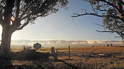
Sunday morning we were treated to some surreal sights. As we drove across one valley into the next, dense fog filled the further valley and poured over in the one we were in. So cool to see, I have no idea why fog would form so densely in one valley but not the adjacent valley. This was nothing though to what we saw later, in the valley with the fog the sun rose and as it started to break up the fog it revealed a wave of fog dense fog that still lingered over the South Tothill Ranges. As the valley cleared completely of fog, the ranges looked like a wave of fog crashing on the valley floor - the ranges couldn't be seen at all.

During the car shuffle, we left six of the group standing the in fog, in the cold, with the sun still behind the dense fog, as we drove in our heated cars to the end of the walk and back (to leave three cars at the end, and one at the start).

Sunday's hike was quite unlike the previous day's hike, there were no road this time, just fire tracks. It was eerie to hike over and through the South Tothill Ranges in the dense fog, as those in front of us disappeared into the fog. By mid morning from the top of a hill we got the occasional glimpse through the passing fog to the valley below.


View photos as full screen slideshow


Stats:

Saturday
  • Distance: 17.6km
  • Start time: 9.10am
  • End time: 2.05pm
  • Moving duration: 3h 23m
  • Stationary duration: 1h 09m
  • Moving average: 5.2km/h
  • Overall average: 3.9km/h
  • Max speed: 9.4km/h
Sunday
  • Distance: 17.1km
  • Start time: 8.30am
  • End time: 2.00pm
  • Moving duration: 3h 39m
  • Stationary duration: 1h 51m
  • Moving average: 4.7km/h
  • Overall average: 3.3km/h
  • Max speed: 10.6km/h